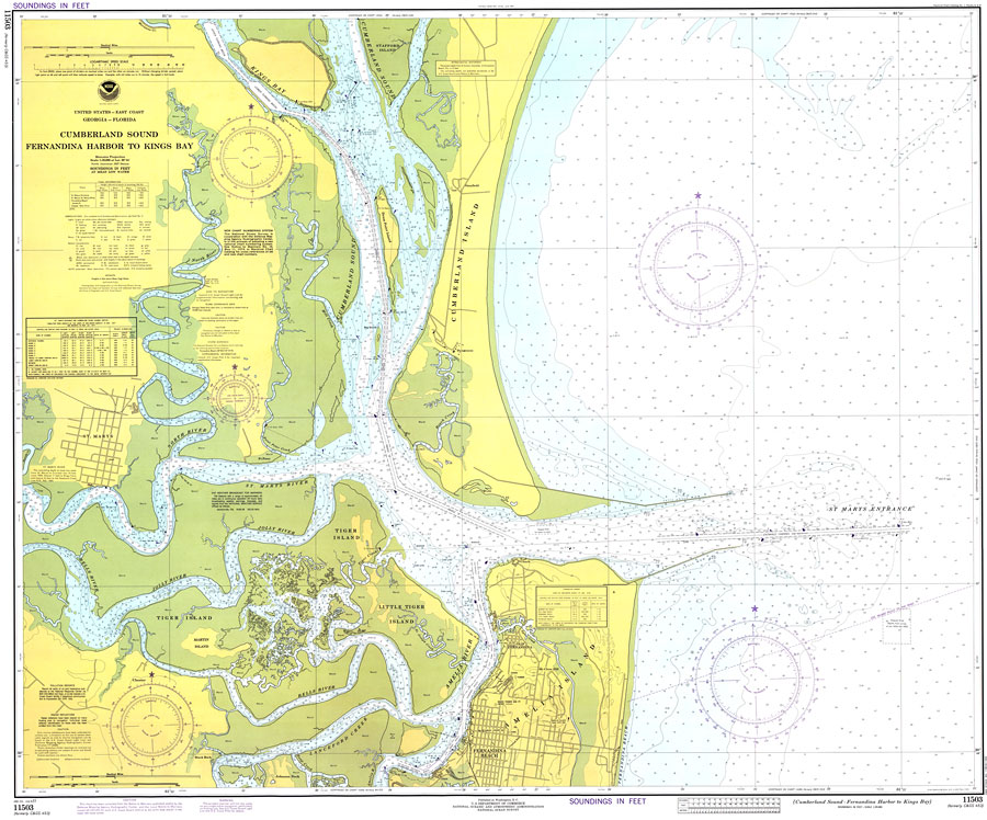
Description: A National Oceanic and Atmospheric Administration map of northern Florida and southern Georgia from Fernandina Harbor to Kings Bay, current to 1977. This National Ocean Survey chart shows all soundings expressed in feet. Navigational aids such as lights, beacons, buoys and measures of magnetic declination variances are shown as well as obstructions such as submerged rock and piles. Tidal information given for St. Marys entrance, St. Marys, Fernandina Beach, and Chester Bells River. North American 1927 Datum used. The map scale is 1:20,000. Key to NOAA maps.
Place Names: 1950-1999, St. Marys, Fernandina Beach,
ISO Topic Categories: transportation, inlandWaters, oceans, elevation
Keywords: Cumberland Sound: Fernandina Harbor to Kings Bay, physical, transportation, hydrological, physical features, roads, railroads, water routes, water depths, transportation, inlandWaters, oceans, elevation, Mercator, 1977
Source: National Oceanic and Atmospheric Administration, National Ocean Survey (Washington, DC: National Oceanic and Atmospheric Administration, 1977)
Map Credit: Courtesy the U.S. National Oceanic and Atmospheric Administration |
|