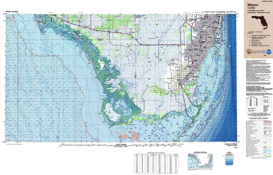
Description: A US Geological Survey and National Ocean Service map of south Florida current to 1988. This topographic-bathymetric map shows elevations and depths in meters. Contour interval 5 meters. Bathymetric contour interval 10 meters. 1989 magnetic declination from true north varies from 1 1/2 degrees westerly for the west edge of the map to 3 degrees westerly for the east edge. Mean annual change is 8.5' westerly. Map also includes roads, waterways, airports, national parks and refuges, swamps, and forests. North American 1927 Datum used. The map scale is 1:250,000, metric . Key to NOAA maps.
Place Names: 1950-1999, Miami, Hollywood, Hallendale, Hialeah, Coral Gables, Kendall, Homestead, Florida City, Key Largo, Marco Island, Everglades City
ISO Topic Categories: transportation, oceans, inlandWaters, elevation, boundaries
Keywords: Miami Area Topographic-Bathymetric Map, physical, political, transportation, hydrological, physical features, topographical, county borders, roads, railroads, water routes, water depths, transportation, oceans, inlandWaters, elevation, boundaries, Unknown,1988
Source: US Geological Survey and National Ocean Service, (Colorado Springs, CO: US Geological Survey, 1988)
Map Credit: Courtesy the U.S. National Oceanic and Atmospheric Administration |
|