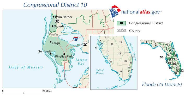
Description: This is a map of Florida's Congressional District 10 in the Congressional Districts of the United States - 107th Congress. It shows main cities, state roads, U. S. highways and county names.
Place Names: 2000-, Palm Harbor, Dunedin, Largo, Seminole, Pinellas Park, Tampa Bay, Gulf of Mexico, Pinellas
ISO Topic Categories: boundaries, transportation, oceans, inlandWaters
Keywords: 107th Congress - Florida's Congressional District 10, transportation, political, county borders, roads, boundaries, transportation, oceans, inlandWaters, Unknown,2001
Source: , National Atlas (U. S. Geological Survey, 2001)
Map Credit: Courtesy of the National Atlas. |
|