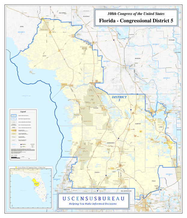
Description: This is a map of Florida's Congressional District 5 in the Congressional Districts of the United States - 108th Congress. It shows map legend, main cities, city roads, state roads, U. S. highways and county names.
Place Names: 2000-, Bronson, Manattee Road, Chiefland, Fanning Springs, Andrews, Levy, Otter Creek, Williston, Cedar Key, Yankeetown, Inglis, Dunnellon, Citrus Springs, Hernando, Pine Ridge, Citrus Hills, Crystal River, Citrus, Homosassa, Homosassa Springs, Sugarmill Woods, Inverness, Sumter, Wildwood, Yalaha, Lake, Clermont, Groveland, Mascotte, Minneola, Citrus Ridge, Webster, Bushnell, Hernando, Floral City, Spring Lake, Spring Hill, Shady Hills, Polk, Polk City, Pasco, Dade City, Land O' Lakes, Zephyrhills, Odessa, Gulf of Mexico
ISO Topic Categories: boundaries, transportation, oceans, inlandWaters
Keywords: 108th Congress - Florida's Congressional District 5, transportation, political, county borders, roads, boundaries, transportation, oceans, inlandWaters, Unknown,2003
Source: United States Census Bureau Geography Division, United States Census Bureau (Government Printing Office, 2003)
Map Credit: Courtesy of the United States Census Bureau. |
|