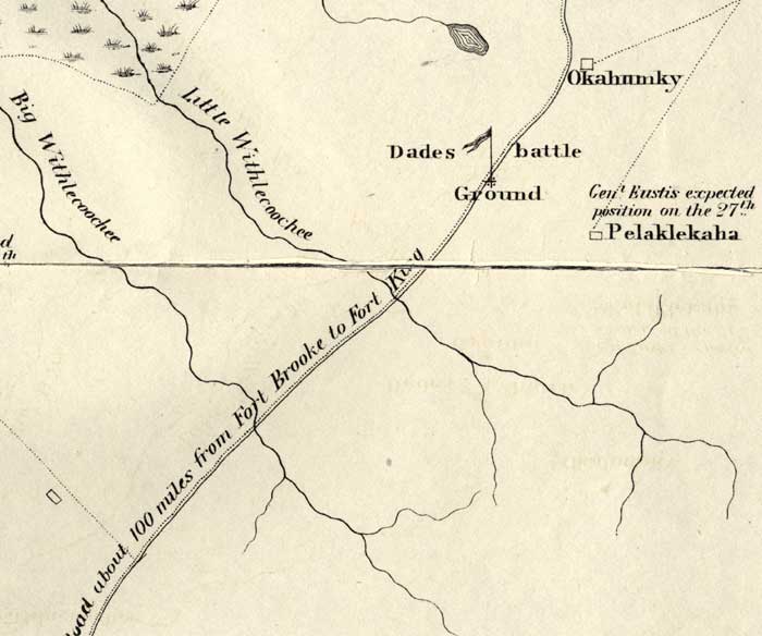
Description: This map shows the Battle Ground of Major Dade, in particular the Pelaklekaha and Okahumky areas. The positions of the troops are noted. Also shown is the military road and inland waters.
Place Names: State, Okahumky, Pelaklekaha, Big Withlecoochee River, Little Withlecoochee River, Seminole
ISO Topic Categories: transportation, inlandWaters, society
Keywords: Detail Map of Major Dade Battle Ground: Dades Battle Ground, physical, transportation, historical, Major Dade, Dade's Battle Ground, physical features, roads, other military, transportation, inlandWaters, society, Unknown,December 28, 1835
Source: J. E. Johnson, Seat of War in Florida (Philadelphia, PA: Bowen & Co., 1836)
Map Credit: Courtesy the private collection of Roy Winkelman. |
|