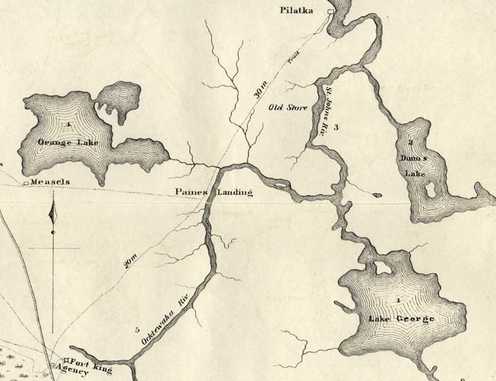
Description: This map shows the Battle Ground of Major Dade, in particular Paines Landing. Shown is the military trail from Fort King to Pilatka or Palatka, inland waters and location of Paines Landing.
Place Names: State, Pilatka, Palatka, St. Johns River, Lake George, Paines Landing, Ocktewaha River, Measels, Orange Lake, Fort King, Agency, Seminole
ISO Topic Categories: transportation, inlandWaters, society
Keywords: Detail Map of Major Dade Battle Ground: Paines Landing, physical, transportation, historical, Major Dade, Dade's Battle Ground, physical features, roads, other military, transportation, inlandWaters, society, Unknown,December 28, 1835
Source: J. E. Johnson, Seat of War in Florida (Philadelphia, PA: Bowen & Co., 1836)
Map Credit: Courtesy the private collection of Roy Winkelman. |
|