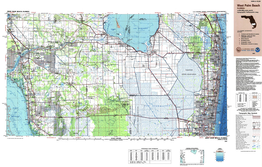
Description: A US Geological Survey and National Ocean Service map of south Florida from Hollywood to West Palm Beach and across to Naples, current to 1987. This topographic-bathymetric map shows elevations and depths in meters. Contour interval 5 meters. Bathymetric contour interval 10 meters. 1988 magnetic declination from true north varies from 2 degrees easterly for the west edge of the map to 3 1/2 degrees easterly for the east edge. Mean annual change is 8.3' westerly. Map also includes roads, waterways, airports, national parks and refuges, swamps, and forests. Map divided into townships and ranges. North American 1929 Datum used. The map scale is 1:250,000, metric . Key to USGS maps.
Place Names: 1950-1999, Fort Lauderdale, West Palm Beach, Fort Myers, Naples, Hollywood, Pompano, Deefield Beach, Cape Coral, Boca Raton, Delray Beach, Lake Worth, Lantana, Cooper City, Davie, Dania, Pembroke Pines
ISO Topic Categories: transportation, inlandWaters, oceans, elevation
Keywords: West Palm Beach to Naples, physical, political, transportation, hydrological, physical features, topographical, county borders, roads, railroads, water routes, water depths, transportation, inlandWaters, oceans, elevation, Unknown,1987
Source: US Geological Survey and National Ocean Service, (Reston, VA: US Geological Survey, 1987)
Map Credit: Courtesy the U.S. National Oceanic and Atmospheric Administration |
|