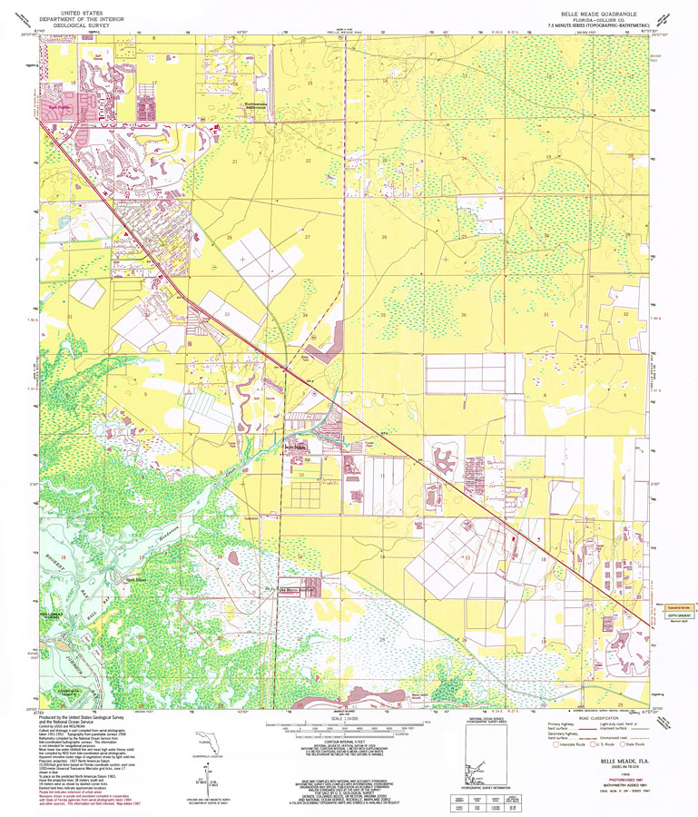
Description: A US Coast and Geodetic Survey and National Ocean Service map of southwest Florida from Belle Meade to East Naples, current to 1987. This topographic-bathymetric map shows elevations and depths in meters. Contour interval 5 meters. Bathymetric contour interval 1 meters. Map also includes roads, waterways, airports, housing developments, golf courses, national parks and refuges, swamps, and forests. Map divided into townships and ranges. North American 1927 Datum used. The map scale is 1:24,000. Key to NOAA maps.
Place Names: 1950-1999, Belle Meade, East Naples, Rattlesnake Hammock
ISO Topic Categories: transportation, inlandWaters, elevation, boundaries, society
Keywords: Belle Meade Quadrangle, physical, political, transportation, hydrological, physical features, topographical, local jurisdictions, roads, railroads, water depths, transportation, inlandWaters, elevation, boundaries, society, Unknown,1987
Source: US Geological Survey and National Ocean Service, (Reston, VA: US Geological Survey, 1987)
Map Credit: Courtesy the U.S. National Oceanic and Atmospheric Administration |
|