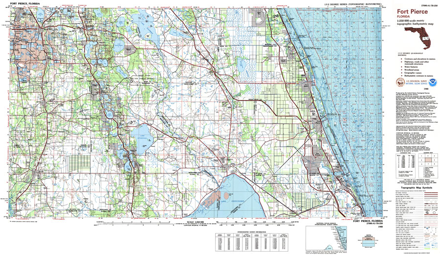
Description: A US Geological Survey and National Ocean Service map of Florida from Palm Bay to Stuart and west to Arcadia. This topographic-bathymetric map shows elevations and depths in meters. Contour interval 10 meters. Bathymetric contour interval 10 meters. 1988 magnetic declination from true north varies from 2 1/2 degrees westerly for the west edge of the map to 4 degrees westerly for the east edge. Mean annual change is 8.5' westerly. Map also includes roads, waterways, airports, national parks and refuges, swamps, and forests. Map divided into townships and ranges. North American 1927 Datum used. The map scale is 1:250,000, metric . Key to NOAA maps.
Place Names: 1950-1999, Palm Bay, Vero Beach, Fort Pierce, Port St. Lucie, Stuart, Indiantown, Okeechobee, Sebring, Placid Lakes, Avon Park, Lake Wales, Fort Meade, Bartow, Gifford
ISO Topic Categories: transportation, oceans, inlandWaters, boundaries, elevation
Keywords: Fort Pierce Quadrangle, physical, political, transportation, hydrological, physical features, topographical, county borders, roads, railroads, transportation, oceans, inlandWaters, boundaries, elevation, Unknown,1988
Source: US Geological Survey and National Ocean Service, (Reston, VA: US Geological Survey, 1988)
Map Credit: Courtesy the U.S. National Oceanic and Atmospheric Administration |
|