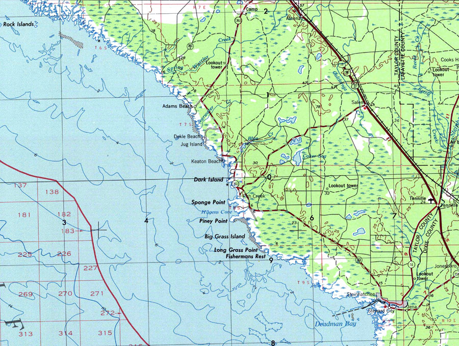
Description: A portion of Gainesville Geological Survey and National Ocean Service map showing the Steinhatchee area current to 1978. The map shows State, primary and secondary roads, railroad lines and airports. Natural features include lakes, rivers and swamps. The map scale is 1:250,000. N.O.A.A. map reference: NH17-7. Key to NOAA maps. PLEASE NOTE: This historical data is not to be used for navigation or navigation planning. The Florida Center for Instructional Technology (FCIT) does not assume responsibility for the improper use of these data.
Place Names: Taylor, Steward City, Athena, Salem, Steinhatchee
ISO Topic Categories: inlandWaters, oceans, transportation
Keywords: Steinhatchee, physical, transportation, hydrological, physical features, topographical, roads, railroads, water depths, inlandWaters, oceans, transportation, Transverse_Mercator, 1978
Source: USGS and NOAA, Gainesville, Florida (Reston, VA: United States Geological Survey, 1978)
Map Credit: Courtesy the U.S. National Oceanic and Atmospheric Administration |
|