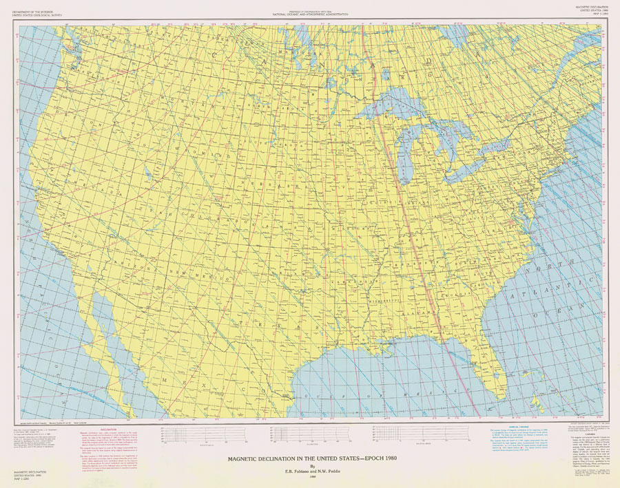
Description: Map of the United States showing lines of equal magnetic declination and equal annual change. Lines of equal magnetic declination (isogonic lines) are shown in red. The lines are solid where the compass points east of true north (east declination), and dashed where it points west of true north (west declination). The isogonic lines are based on a set of 7th-degree polynomials. Lines of equal annual change (isoporic lines) are shown in blue. The lines are solid where the change is eastward, and dashed where the change is westward. The isoporic lines are based on a 6th-degree polynomial. — Fabiano and Peddie, 1980. The map scale is 1:5,000,000.
Place Names: 1950-1999, United States, Gulf of Mexico, Canada,
ISO Topic Categories: inlandWaters, boundaries, geoscientificInformation, oceans
Keywords: Magnetic Declination In The United States - Epoch 1980, physical, political, magnetic, physical features, country borders, major political subdivisions, inlandWaters, boundaries, geoscientificInformation, oceans, Lambert_Conformal_Conic, 1980
Source: E. B. Fabiano and N. W. Peddie, Magnetic Declination United States-1980 (Reston, VA: U.S.G.S., 1980)
Map Credit: Courtesy the U.S. National Oceanic and Atmospheric Administration |
|