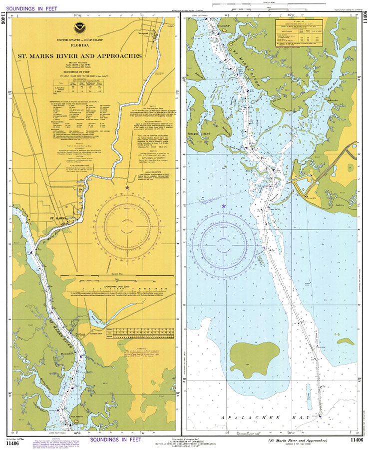
Description: A National Oceanic and Atmospheric Administration map showing the approaches to the Saint Marks River from the Apalachee Bay in the northeastern Gulf of Mexico current to 1979. This chart also shows river navigation to the cities of Saint Marks and Newport with all soundings expressed in feet. Navigational aids such as lights, beacons, buoys, safety fairways and measures of magnetic declination variances are shown as well as obstructions such as fixed bridges and submerged wreckage. The map scale is 1:15,000. Chart is LORAN-A/C overprinted. North American Datum 1927 is used. Key to NOAA maps.
Place Names: Wakulla, St. Marks, Newport
ISO Topic Categories: inlandWaters, transportation
Keywords: St. Marks River and Approaches, physical, transportation, hydrological, physical features, water routes, roads, water depths, inlandWaters, transportation, Mercator, 1979
Source: National Oceanic and Atmospheric Administration, National Ocean Survey (Washington, DC: U. S. Department of Commerce, 1979)
Map Credit: Courtesy the U.S. National Oceanic and Atmospheric Administration |
|