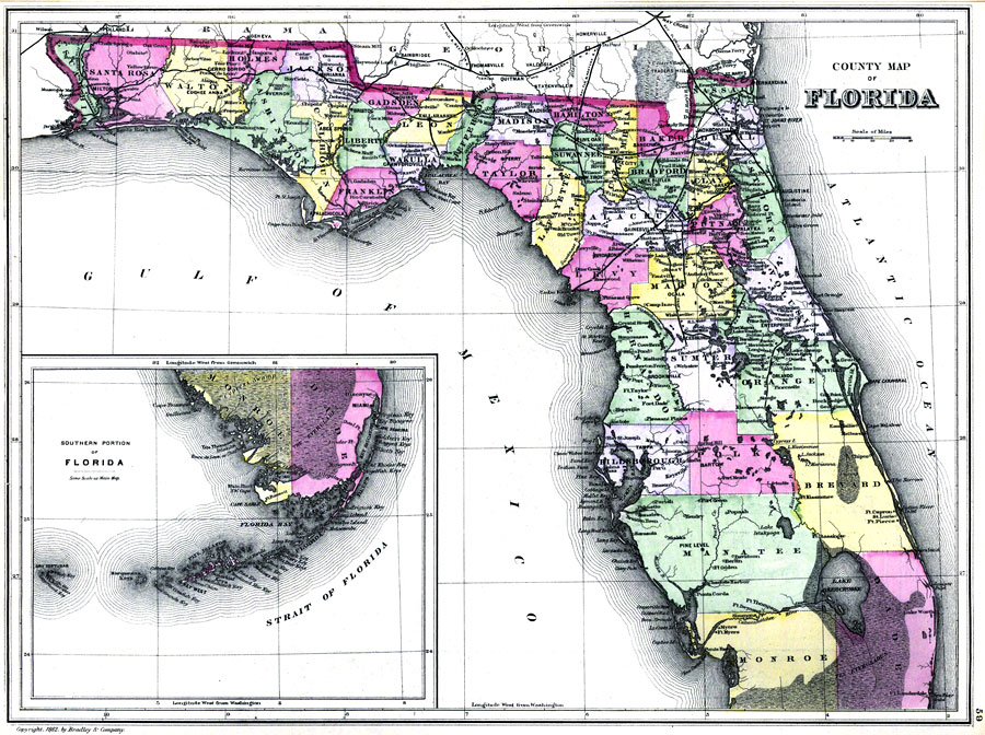
Description: Digitization provided by the USF Libraries Digitization Center. Rare Maps. This is a detailed, hand colored map of Florida showing counties, railroads, etc. Includes grid. Insets: North-western portion of Dry Tortugas. Measurements.Dimensions: 56 x 40 cm.Measurements.Format: Scale [1:1,267,200]
Place Names: 1880-1899, Atlantic Ocean, Jacksonville, Pensacola, Apalachicola, Tallahassee, Saint Augustine, Gainesville, Tampa, Cape Canaveral, Fernandina, Brooksville, Sarasota, Miami, Fort Myers, Lake Okeechobee, Fort Lauderdale, Gulf of Mexico, Key West
ISO Topic Categories: inlandWaters, oceans, boundaries, transportation
Keywords: County Map of Florida, physical, historical, political, transportation, country borders, county borders, railroads, inlandWaters, oceans, boundaries, transportation, Unknown,1882
Source: Bradley and Company, Bradley's atlas of the world for commercial and library reference. (Philadelphia, PA: Wm. M. Bradley and Bros., 1882)
Map Credit: Courtesy of the Special Collections Department, University of South Florida. |
|