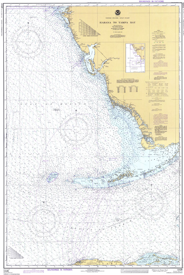
Description: A National Oceanic and Atmospheric Administration map of Gulf Coast, from Tampa Bay to Havana, Cuba, current to 1977. This Department of Commerce chart shows all soundings expressed in fathoms at mean low water. Navigational aids such as lights, beacons, buoys and measures of magnetic declination variances are shown as well as obstructions such as shoals, submerged piles, wreckages and fixed bridges. The map scale is 1:470,940. North American Datum of 1927 is used. Chart is LORAN-A overprinted. Key to NOAA maps.
Place Names: 1950-1999, Sarasota, Key West, Florida Keys, Florida Bay, Cape Sable, Charlotte Harbor, Sarasota Bay, Bradenton, Tampa Bay, Punta Gorda, Fort Myers, Cuba, Puerto Habana, Straits of Florida, Puerto Matanzas,
ISO Topic Categories: inlandWaters, transportation, oceans
Keywords: Habana to Tampa Bay, physical, transportation, hydrological, physical features, roads, railroads, water routes, water depths, inlandWaters, transportation, oceans, Mercator, 1977
Source: National Oceanic and Atmospheric Administration, United States - Gulf Coast, Florida (Washington, D.C.: U.S. Department of Commerce, 1977)
Map Credit: Courtesy the U.S. National Oceanic and Atmospheric Administration |
|