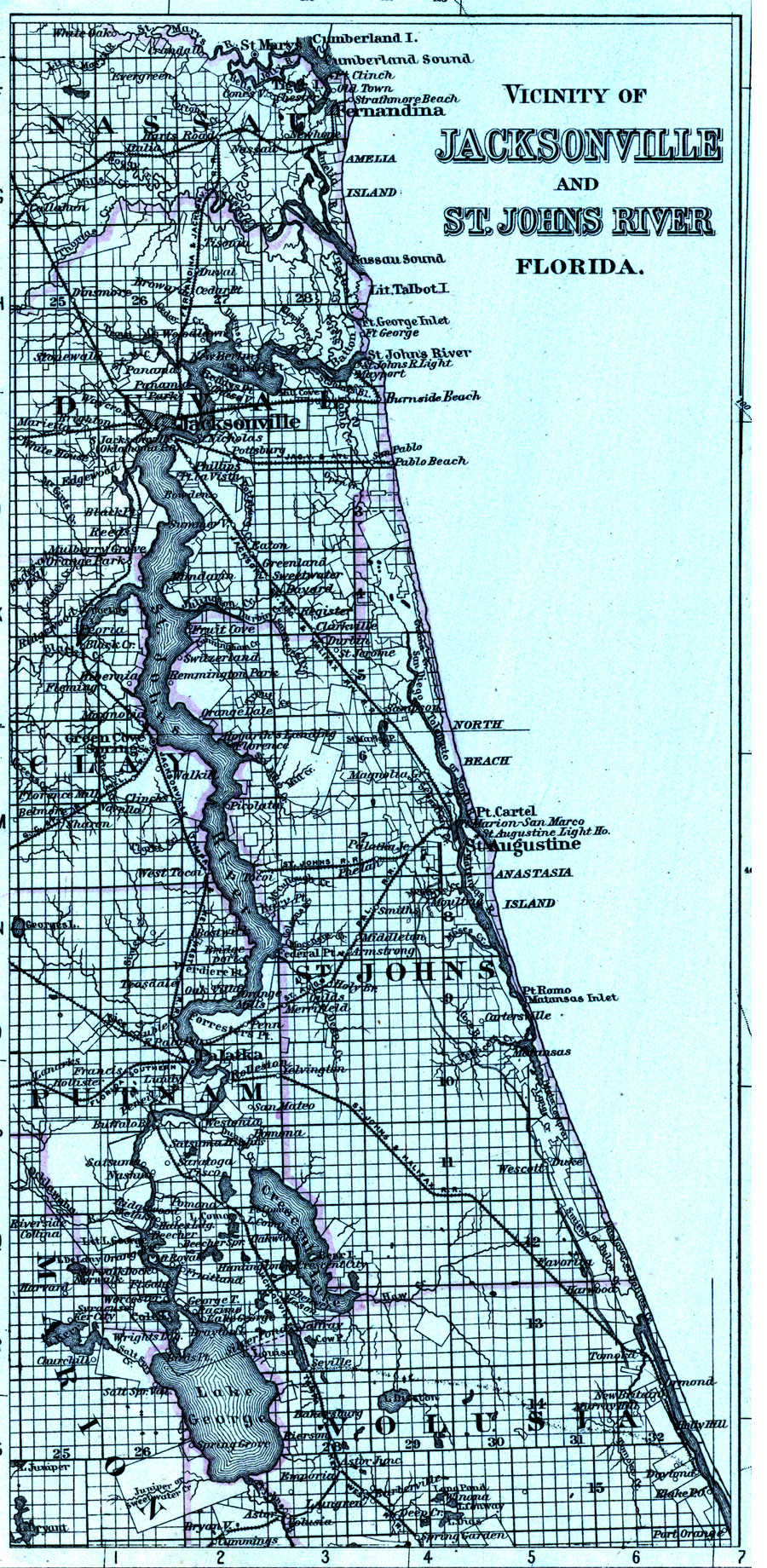
Description: An inset map of the vicinity of Jacksonville and the St. Johns River including Fernandina and much of Nassau County south to Lake George in Marion and Volusia counties. The map shows major cities, roads, railroads, inland waters, etc. Township and range grid established from the Tallahassee baseline and meridian and various land grants and claims shows the extent of land survey of the area in 1886.
Place Names: 1880-1899,
ISO Topic Categories: boundaries, inlandWaters, transportation
Keywords: Vicinity of Jacksonville and St. Johns River, Florida, physical, political, transportation, physical features, county borders, railroads, water routes, boundaries, inlandWaters, transportation, Unknown,1886
Source: Ormando Willis Gray, Gray's Atlas (Phiadelphia, PA: O. W. Gray and Son, 1886) 91
Map Credit: Courtesy of the Special Collections Department, University of South Florida. |
|