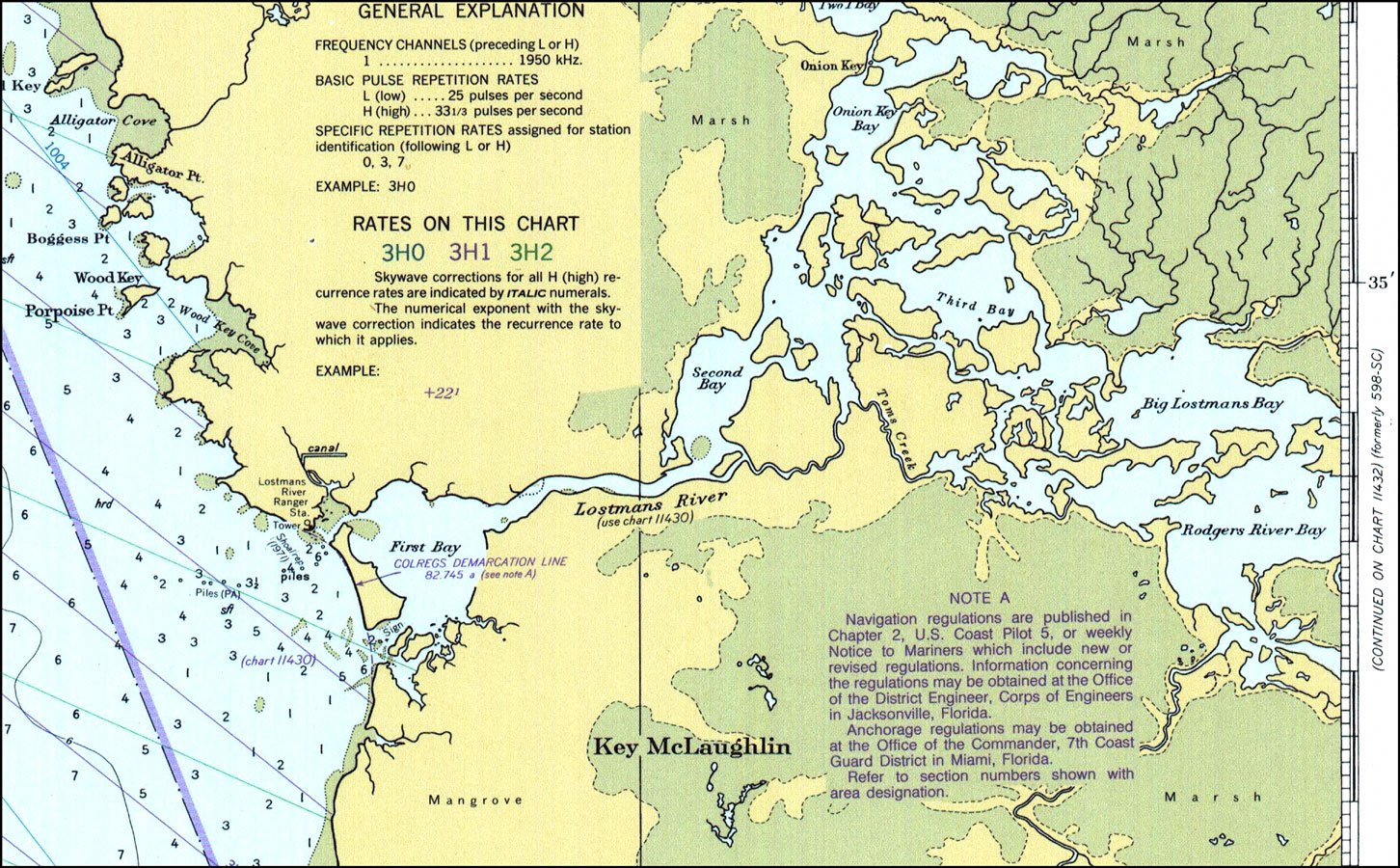
Description: A National Oceanic and Atmospheric Administration map of Lostmans River current to 1977. This Department of Commerce chart shows all soundings expressed in feet at Gulf Coast low water Datum. Navigational aids such as lights are shown as well as obstructions such as shoals and submerged piles. The map scale is 1:80,000. North American Datum of 1927 is used. Chart is LORAN-A overprinted. Key to NOAA maps.
Place Names: Monroe, Key McLaughlin, Lostmans River, Porpoise Pt.,
ISO Topic Categories: inlandWaters, transportation
Keywords: Lostmans River, physical, transportation, hydrological, physical features, water routes, water depths, inlandWaters, transportation, Mercator, 1977
Source: National Oceanic and Atmospheric Administration, East Cape to Mormon Key (Washington, DC: U.S. Department of Commerce, 1977)
Map Credit: Courtesy the U.S. National Oceanic and Atmospheric Administration |
|