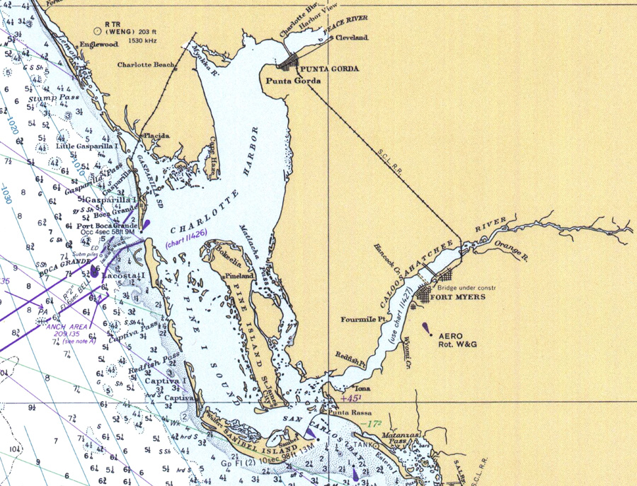
Description: A National Oceanic and Atmospheric Administration map of the Charlotte Harbor area from Englewood to Sanibel Island, current to 1977. This Department of Commerce chart shows all soundings expressed in fathoms at mean low water. Navigational aids such as lights, beacons and buoys are shown as well as obstructions such as shoals, submerged piles, wreckages and fixed bridges. The map scale is 1:470,940. North American Datum of 1927 is used. Chart is LORAN-A overprinted. Key to NOAA maps.
Place Names: 1950-1999, Fort Myers, Punta Gorda, Charlotte Harbor,Pine Sound, Pine Island, Placida, Englewood, Gasparilla Pass, Lacosta Island, San Carlos Bay, Sanibel Island,
ISO Topic Categories: oceans, inlandWaters, transportation
Keywords: Charlotte Harbor, physical, transportation, hydrological, physical features, railroads, water routes, water depths, oceans, inlandWaters, transportation, Mercator, 1977
Source: National Oceanic and Atmospheric Administration, Habana To Tampa Bay (Washington, D.C.: U.S. Department of Commerce, 1977)
Map Credit: Courtesy the U.S. National Oceanic and Atmospheric Administration |
|