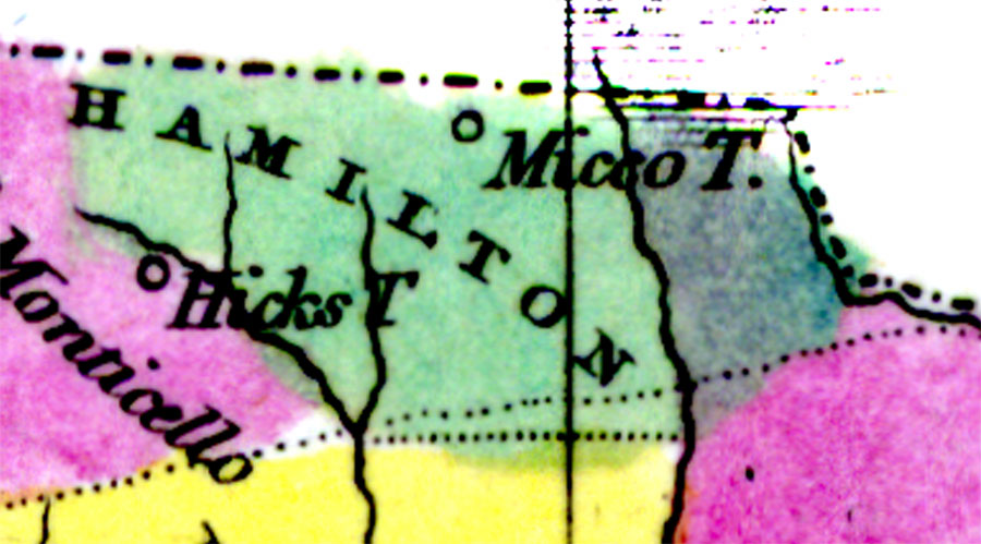
Description: Digitization provided by the USF Libraries Digitization Center. Rare Maps. This is a detail map of Hamilton county circa 1834. It shows important cities and towns of the time including Micco Town. It also shows inland waters including the Amasura (or Amazura) River which is now the Withlacoochee River.
Place Names: Hamilton, Micco Town, Amasura River, Amazura River, Withlacoochee River
ISO Topic Categories: inlandWaters, boundaries
Keywords: Hamilton County, physical, historical, political, physical features, county borders, country borders, inlandWaters, boundaries, Unknown,1834 AD
Source: William Darby, Memoir on the geography and natural and civil history of Florida (Philadelphia, PA: Thomas H. Palmer, 1834)
Map Credit: Courtesy of the Special Collections Department, University of South Florida. |
|