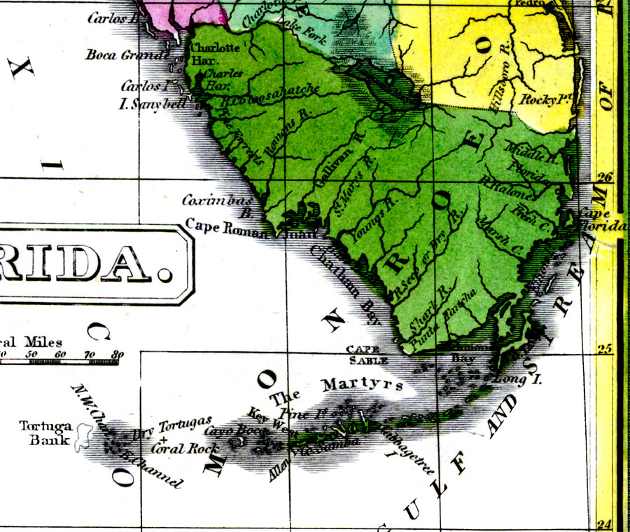
Description: Digitization provided by the USF Libraries Digitization Center. Rare Maps. This is a detail map of Monroe county circa 1834 when it encompassed the entire southern portion of Florida and the Florida Keys. It shows main towns and cities including Key West, Florida and Sanibel (Sanybell) Island. It also shows inland waters including the Caloosahatchee (Coloosahatche) River.
Place Names: Monroe, Charlotte Harbor, Lake Okeechobee, Sanibel Island, Sanybell Island, Cape Roman, Chatham Bay, Gallivan River, Caloosahatchee River, Coloosahatche River, Florida, Middle River, Cape Florida, Key West, Dry Tortugas, Cape Sable, Gulf of Mexico, Atlantic Ocean
ISO Topic Categories: inlandWaters, boundaries, oceans
Keywords: Monroe County, physical, historical, political, physical features, county borders, inlandWaters, boundaries, oceans, Unknown,1834 AD
Source: William Darby, Memoir on the geography and natural and civil history of Florida (Philadelphia, PA: Thomas H. Palmer, 1834)
Map Credit: Courtesy of the Special Collections Department, University of South Florida. |
|