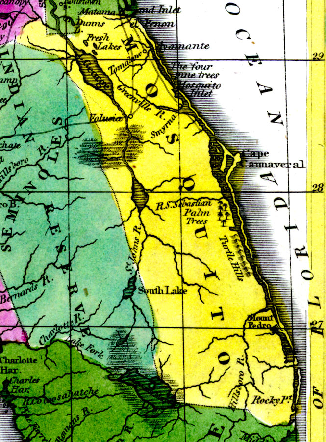
Description: Digitization provided by the USF Libraries Digitization Center. Rare Maps. This is a detail map of Mosquito county circa 1834. Mosquito county does not exist any longer, but it encompassed the east coast from present day Flagler county south through Broward county. It shows main towns and cities including Cape Canaveral. It also shows inland waters including Lake George.
Place Names: Mosquito, Atlantic Ocean, Rocky Pt., Hillsboro River, Mount Pedro, Volusia, Greenville River, Smyrna, Mosquito Inlet, Cape Canaveral, Fresh Lakes, Lake George, Ayamante, Tomaleow, Cape Cannaveral
ISO Topic Categories: inlandWaters, boundaries, oceans
Keywords: Mosquito County, physical, historical, political, physical features, county borders, inlandWaters, boundaries, oceans, Unknown,1834 AD
Source: William Darby, Memoir on the geography and natural and civil history of Florida (Philadelphia, PA: Thomas H. Palmer, 1834)
Map Credit: Courtesy of the Special Collections Department, University of South Florida. |
|