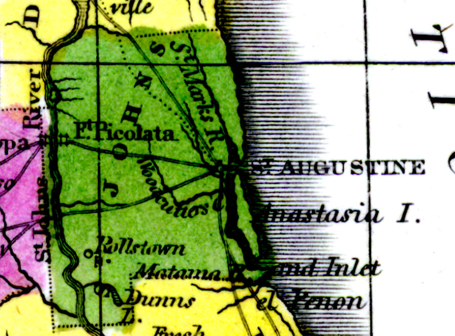
Description: Digitization provided by the USF Libraries Digitization Center. Rare Maps. This is a detail map of St. Johns county circa 1834. It shows main towns and cities including Ft. Picolata which was one of two Spanish forts built to protect them from Indians while crossing the St. Johns River. It also shows inland waters including the St. Marks and St. Johns Rivers.
Place Names: St. Johns, St. Johns River, Ft. Picolata, Fort Picolata, St. Marks River, Rollstown, St. Augustine, Saint Augustine, Anastasia Island, Atlantic Ocean
ISO Topic Categories: inlandWaters, boundaries, oceans
Keywords: St. Johns County, physical, historical, political, physical features, county borders, inlandWaters, boundaries, oceans, Unknown,1834 AD
Source: William Darby, Memoir on the geography and natural and civil history of Florida (Philadelphia, PA: Thomas H. Palmer, 1834)
Map Credit: Courtesy of the Special Collections Department, University of South Florida. |
|