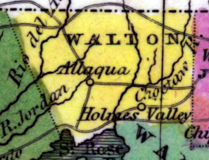
Description: Digitization provided by the USF Libraries Digitization Center. Rare Maps. This is a detail map of Walton county circa 1834. It shows main towns and cities including Allaqua (Alaqua Creek). It also shows inland waters including Rio del Almirante (or as shown on the map as Amirante) which is the River of the Admiral dedicated to the Spanish Admiral Andres de Pez which is now the Yellow River.
Place Names: Walton, Allaqua, Holmes Valley, Choctaw River, Jordan River, Rio del Almirante, Gulf of Mexico, Alaqua Creek
ISO Topic Categories: inlandWaters, boundaries, oceans
Keywords: Walton County, physical, historical, political, physical features, county borders, country borders, inlandWaters, boundaries, oceans, Unknown,1834 AD
Source: William Darby, Memoir on the geography and natural and civil history of Florida (Philadelphia, PA: Thomas H. Palmer, 1834)
Map Credit: Courtesy of the Special Collections Department, University of South Florida. |
|