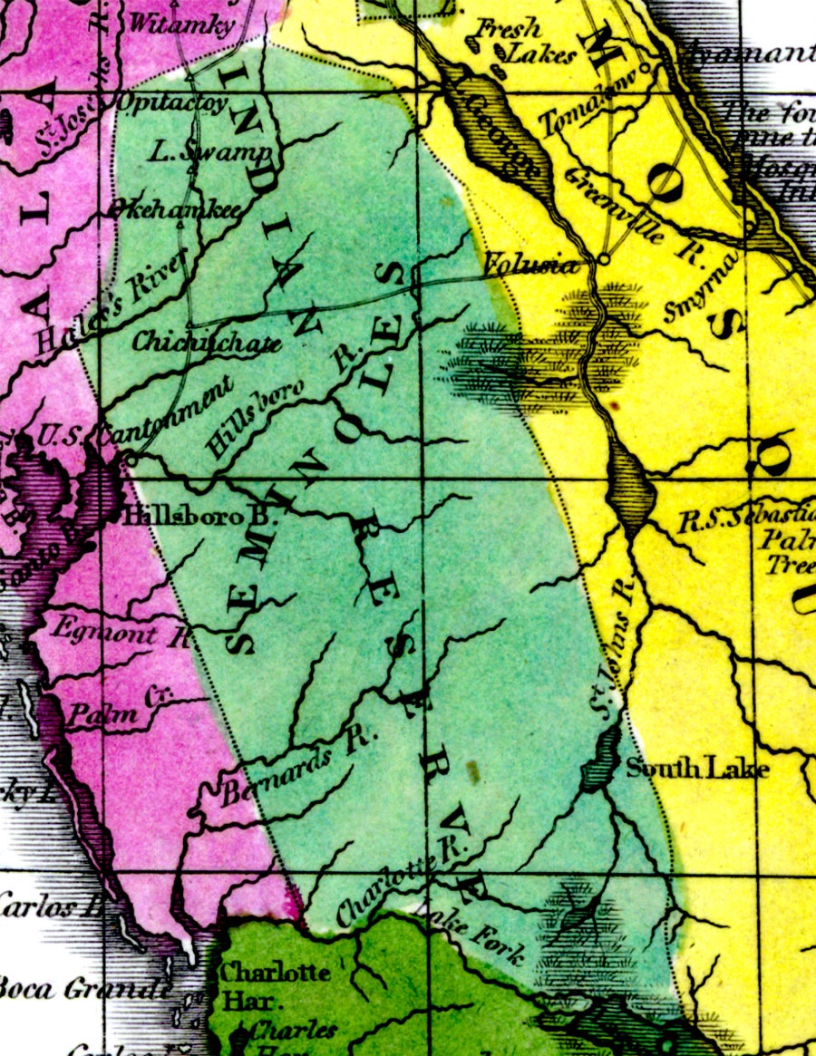
Description: Digitization provided by the USF Libraries Digitization Center. Rare Maps. This is a detail map of the Seminole Native American Reserve circa 1834. It shows main towns and cities including Chichuchate (or Chicuchaty) which was a Seminole settlement. It also shows inland waters including the Hillsborough (Hillsboro) River.
Place Names: State, reserve, reservation, Seminole, Hillsboro River, Hillsborough River, Lake Okeechobee, Okehamkee, Chichuchate, Chicuchaty, Chichichate, Chocachatti, Chocachatee
ISO Topic Categories: inlandWaters, boundaries
Keywords: Seminole Indian Reserve, physical, historical, political, physical features, county borders, inlandWaters, boundaries, Unknown,1834
Source: William Darby, Memoir on the geography and natural and civil history of Florida (Philadelphia, PA: Thomas H. Palmer, 1834)
Map Credit: Courtesy of the Special Collections Department, University of South Florida. |
|