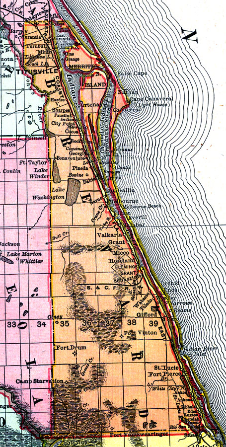
Description: Digitization provided by the USF Libraries Digitization Center. Rare Maps. This is a detail map of Brevard county circa 1898. This map shows section township range (STR). Main cities and towns are shown such as the county seat Titusville. Inland waters are also shown such as Lake Washington. It also shows the area of the Fleming Grant. Scale: Statute Miles, 19 = 1 inch. Engraved, printed and published by Rand, McNally & Company.
Place Names: Brevard, Merritts Island, Cape Canaveral, Titusville, Aurantia, Turnbul, Mims, Indian River, Hardee, Cocoa, Indianola, Valkaria, Grant, Melbourne, Melbourne Beach, Flemings Grant, Micco, Sebastian, Orchid, Enos, Vero, St. Lucie River, Atlantic Ocean, Lake Washington, Fort Drum, Fort Pierce, Merritt Island, Eau Gallie
ISO Topic Categories: inlandWaters, boundaries, transportation, oceans
Keywords: Brevard County, physical, historical, political, transportation, physical features, county borders, railroads, inlandWaters, boundaries, transportation, oceans, Unknown,1898 AD
Source: Rand, McNally and Company, Rand, McNally and Company's Indexed atlas of the world. Florida. (Chicago, IL: Rand, McNally and Company, 1898) 311
Map Credit: Courtesy of the Special Collections Department, University of South Florida. |
|