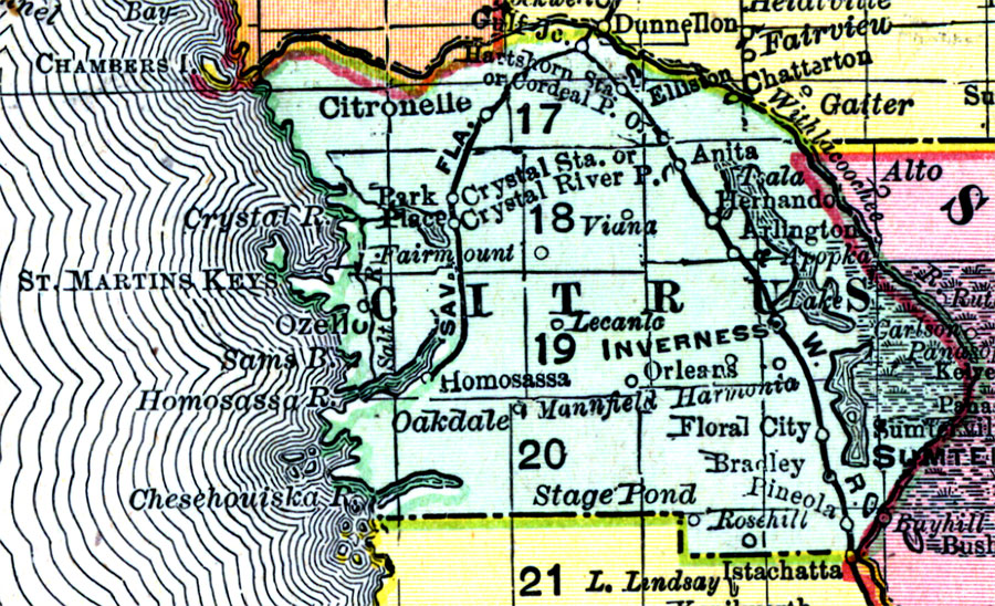
Description: Digitization provided by the USF Libraries Digitization Center. Rare Maps. This is a detail map of Citrus county circa 1898. This map shows section township range (STR). Main cities and towns are shown such as the county seat Inverness. Inland waters are also shown such as the Crystal River and Apopka Lake. Scale: Statute Miles, 19 = 1 inch. Engraved, printed and published by Rand, McNally & Company.
Place Names: Citrus, Citronelle, Crystal River, Inverness, Floral City, Oakdale, Homosassa, Hernando, Arlington, Lake Apopka, Pineola, Bradley, Ozello, Stage Pond, Fairmount, Viana, St. Martins Keys, Lecanto, Gulf of Mexico, Chassahowitzka River, Chesehouiska River, Rosehill, Mannfield
ISO Topic Categories: inlandWaters, boundaries, transportation, oceans
Keywords: Citrus County, physical, historical, political, transportation, physical features, county borders, railroads, inlandWaters, boundaries, transportation, oceans, Unknown,1898 AD
Source: Rand, McNally and Company, Rand, McNally and Company's Indexed atlas of the world. Florida. (Chicago, IL: Rand, McNally and Company, 1898) 311
Map Credit: Courtesy of the Special Collections Department, University of South Florida. |
|