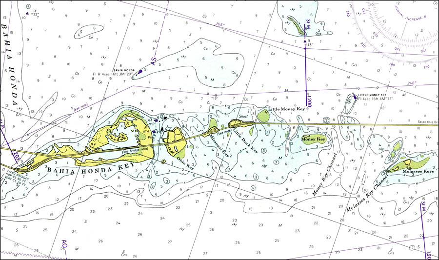
Description: A National Oceanic and Atmospheric Administration map of Bahia Honda Key 1975. This Survey chart shows all soundings and heights expressed in feet. Navigational aids such as lights, beacons and buoys are shown as well as obstructions such as shoals, submerged piles and fixed bridges. The map scale is 1:40,000. Key to NOAA maps.
Place Names: Monroe, Bahia Honda Key,
ISO Topic Categories: oceans, transportation
Keywords: Bahia Honda Key, physical, transportation, hydrological, physical features, roads, water routes, water depths, oceans, transportation, Mercator, 1977
Source: National Oceanic and Atmospheric Administration, Grassy Key to Bahia Honda Key (Washington, DC: U.S. Department of Commerce, 1977)
Map Credit: Courtesy the U.S. National Oceanic and Atmospheric Administration |
|