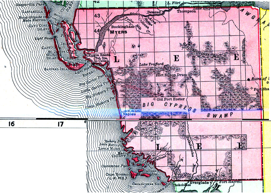
Description: Digitization provided by the USF Libraries Digitization Center. Rare Maps. This is a detail map of Lee county circa 1898. This map shows section township range (STR). Main cities and towns are shown such as the county seat Myers (Ft. Myers). Inland waters are also shown such as the Caloosahatchee River. Scale: Statute Miles, 19 = 1 inch. Engraved, printed and published by Rand, McNally & Company.
Place Names: Lee, Myers, Fort Myers, Buckingham, Thompson, Denaud, Aiva, Caloosa, Caloosahatchee River, Punta Rassa, Sanibel Island, Pine Island, Fort Simon Drum, Fort Shackleford, Okaloacoochee Slough, Old Fort Foster, Naples, Ft. Myers, Sanibel, Captiva, Gulf of Mexico, Marco, Cape Romano, Gullivan's Bay, Chokoloskee Key
ISO Topic Categories: inlandWaters, boundaries, transportation, oceans
Keywords: Lee County, physical, historical, political, transportation, physical features, county borders, railroads, inlandWaters, boundaries, transportation, oceans, Unknown,1898 AD
Source: Rand, McNally and Company, Rand, McNally and Company's Indexed atlas of the world. Florida. (Chicago, IL: Rand, McNally and Company, 1898) 311
Map Credit: Courtesy of the Special Collections Department, University of South Florida. |
|