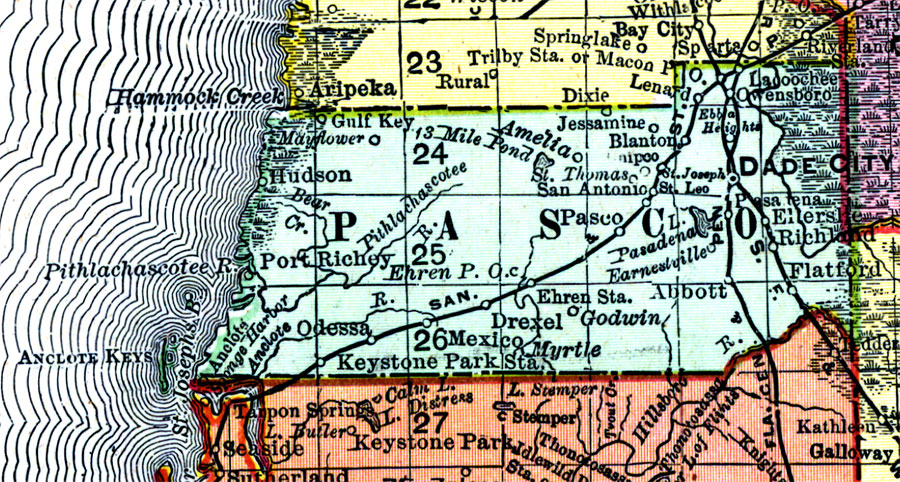
Description: Digitization provided by the USF Libraries Digitization Center. Rare Maps. This is a detail map of Pasco county circa 1898. This map shows section township range (STR). Main cities and towns are shown such as the county seat Dade City. Inland waters are also shown such as the Withlacoochee River on the east border. Scale: Statute Miles, 19 = 1 inch. Engraved, printed and published by Rand, McNally & Company.
Place Names: Pasco, Odessa, Port Richey, Dade City, Drexel, Hudson, Lacoochee, St. Leo, Amelia, Elfers, Flatford, Blanton, San Antonio, Mexico, Myrtle, Anclote, Gulf Key, Gulf of Mexico
ISO Topic Categories: inlandWaters, boundaries, transportation, oceans
Keywords: Pasco County, physical, historical, political, transportation, physical features, county borders, railroads, inlandWaters, boundaries, transportation, oceans, Unknown,1898 AD
Source: Rand, McNally and Company, Rand, McNally and Company's Indexed atlas of the world. Florida. (Chicago, IL: Rand, McNally and Company, 1898) 311
Map Credit: Courtesy of the Special Collections Department, University of South Florida. |
|