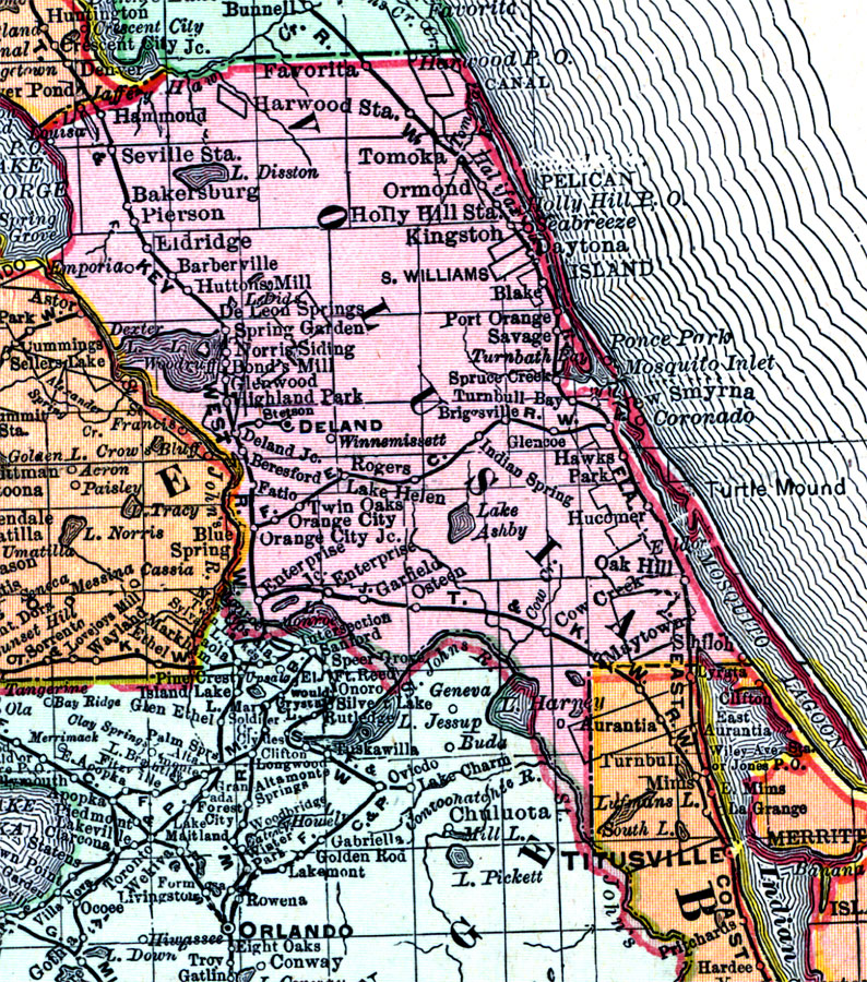
Description: Digitization provided by the USF Libraries Digitization Center. Rare Maps. This is a detail map of Volusia county circa 1898. This map shows section township range (STR). Main cities and towns are shown such as the county seat Deland. Inland waters are also shown such as Lake Woodruff. Scale: Statute Miles, 19 = 1 inch. Engraved, printed and published by Rand, McNally & Company.
Place Names: Volusia, Deland, Kingston, Hammond, Bakersburg, Pierson, Eldridge, Barberville, Huttons Mill, Spring Garden, De Leon Springs, Lake Helen, Norris Siding, Bond's Mill, Glenwood, Indian Spring, Oak Hill, Atlantic Ocean, Daytona, New Smyrna, Coronado, Turtle Mound, Winnemissett, Lake Woodruff, Mosquito Lagoon, Osteen
ISO Topic Categories: inlandWaters, boundaries, transportation, oceans
Keywords: Volusia County, physical, historical, political, transportation, physical features, county borders, railroads, inlandWaters, boundaries, transportation, oceans, Unknown,1898 AD
Source: Rand, McNally and Company, Rand, McNally and Company's Indexed atlas of the world. Florida. (Chicago, IL: Rand, McNally and Company, 1898) 311
Map Credit: Courtesy of the Special Collections Department, University of South Florida. |
|