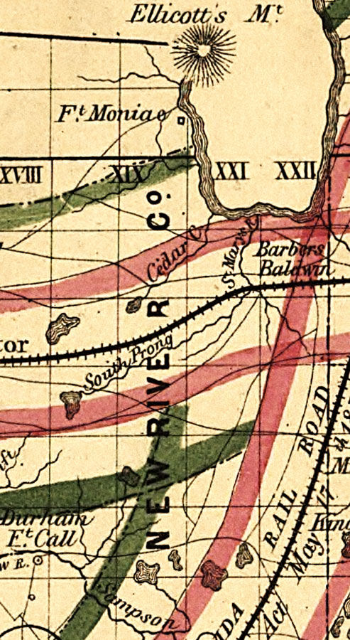
Description: Railroad map of New River County, Florida showing river drainage, cities and towns, roads, railroads, location of the land grant railroads and indicating the 6-mile (red) and 15-mile (green) limits of grants in 1859. Township grids based on the Tallahassee basis parallel and the Tallahassee prime meridian shows the extent of land survey in Florida. The map scale is 1:1,140,480.
Place Names: Bradford, Baldwin, Barbers, Ft. Moniac, Cedar River
ISO Topic Categories: transportation, inlandWaters, boundaries
Keywords: New River County, physical, political, transportation, physical features, county borders, railroads, roads, transportation, inlandWaters, boundaries, Unknown,1859
Source: , Annual Report of the Surveyor General for 1859 (New York, NY: General Land Office, 1859)
Map Credit: Courtesy of the Geography and Map Division of the Library of Congress. |
|