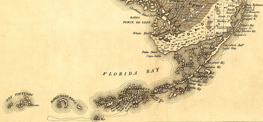
Description: Map of the Florida Keys from Boca Rabones (Boca Raton) to the Dry Tortugas taken from a 1859 railroad map of Florida. The map scale is 1:1,140,480.
Place Names: Monroe, Big Pine, Cape Sable, Key Largo, Key West, Shell Key, Sugarloaf Key, Ten Thousand Islands, Tavernier
ISO Topic Categories: transportation, inlandWaters, boundaries
Keywords: The Florida Keys, physical, political, transportation, physical features, county borders, railroads, roads, transportation, inlandWaters, boundaries, Unknown,1859
Source: , Annual Report of the Surveyor General for 1859 (New York, NY: General Land Office, 1859)
Map Credit: Courtesy of the Geography and Map Division of the Library of Congress. |
|