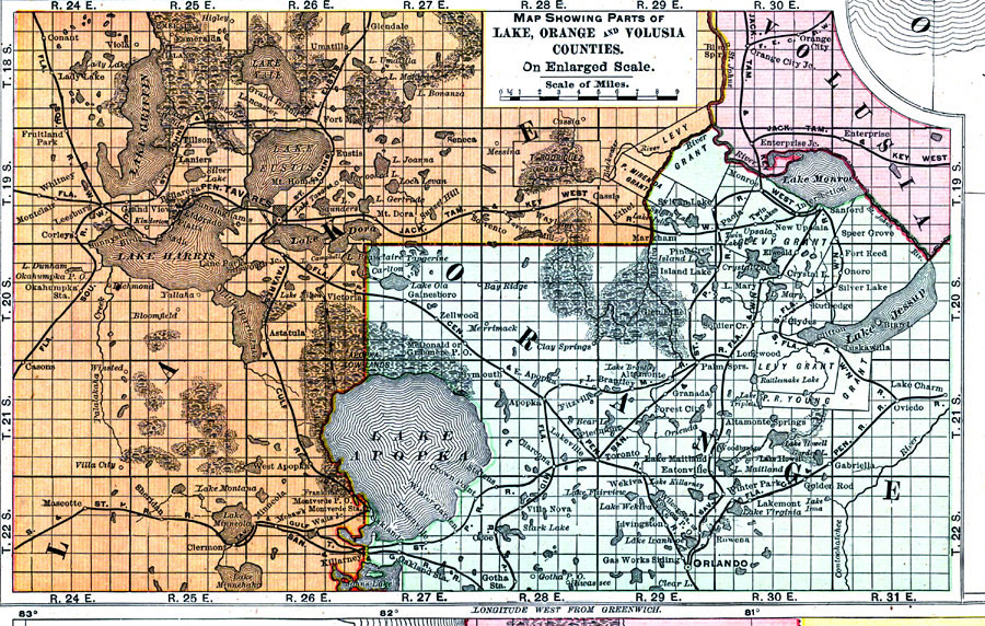
Description: Digitization provided by the USF Libraries Digitization Center. Rare Maps. This is a detail map of Lake, Orange and Volusia counties circa 1898. This map shows section township range (STR). Main cities and towns are shown such as the county seat of Orange county, Orlando. Inland waters are also shown such as Lake Apopka. Scale: Statute Miles, 19 = 1 inch. Engraved, printed and published by Rand, McNally & Company.
Place Names: 1880-1899, Orlando, Tavares, Lake Apopka, P. R. Young Grant, Levy Grant, Altamonte Springs, Oviedo, Orange City, St. Johns River, T. Rodriguez Grant, P. Mirenda Grant, Lake Harris, Fruitland Park, Umatilla
ISO Topic Categories: inlandWaters, boundaries, transportation
Keywords: Map Showing Parts of Lake, Orange and Volusia Counties, physical, historical, political, transportation, physical features, county borders, railroads, inlandWaters, boundaries, transportation, Unknown,1898 AD
Source: Rand, McNally and Company, Rand, McNally and Company's Indexed atlas of the world. Florida. (Chicago, IL: Rand, McNally and Company, 1898) 311
Map Credit: Courtesy of the Special Collections Department, University of South Florida. |
|