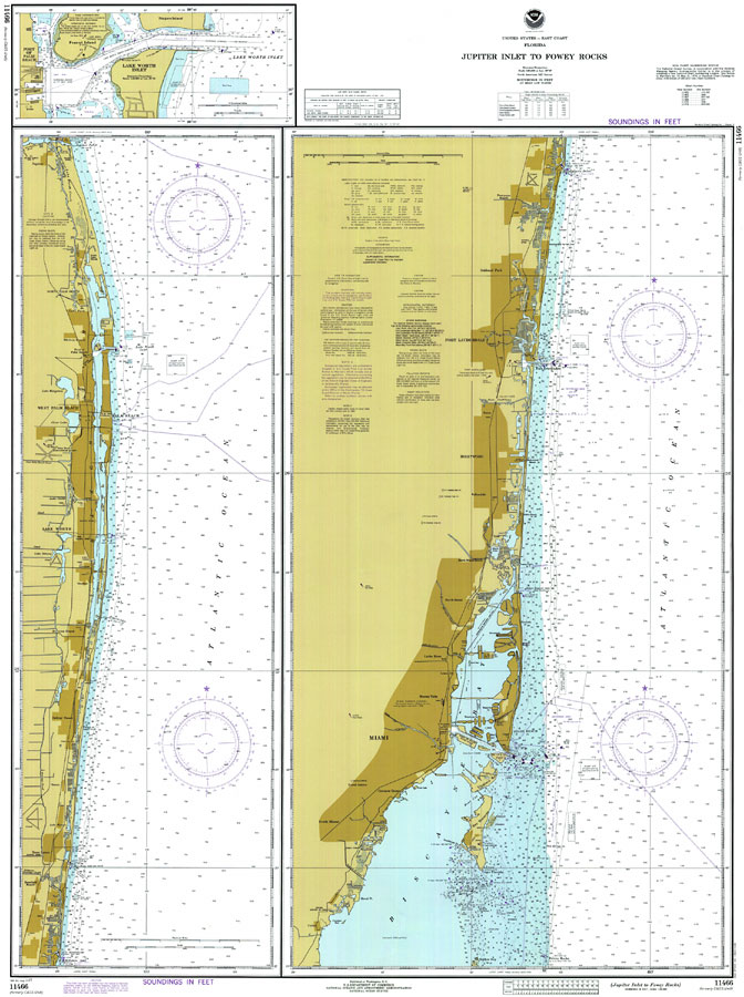
Description: A National Oceanic and Atmospheric Administration map of South Florida, from Jupiter Inlet to Fowey Rocks current to 1999. This Department of Commerce chart shows all soundings expressed in feet at mean lower low water. Navigational aids such as lights, beacons, buoys and measures of magnetic declination variances are shown as well as obstructions such as shoals, submerged piles, wreckages, fixed bridges and overhead cables. The map scale is 1:80,000. North American Datum of 1927 is used. A detailed map of the Port of Palm Beach and Lake Worth Inlet is included. Key to NOAA maps.
Place Names: 1950-1999, Miami, Fort Lauderdale, West Palm Beach, Palm Beach, Port Everglades, Hollywood Beach, Miami Beach, Port of Palm Beach, Lake Worth Inlet,
ISO Topic Categories: inlandWaters, oceans, transportation
Keywords: Jupiter Inlet to Fowey Rocks, physical, transportation, hydrological, physical features, roads, water routes, railroads, water depths, inlandWaters, oceans, transportation, Mercator, 1977
Source: National Oceanic and Atmospheric Administration, United States - East Coast Florida (Washington, D.C.: U.S. Department of Commerce, 1977)
Map Credit: Courtesy the U.S. National Oceanic and Atmospheric Administration |
|