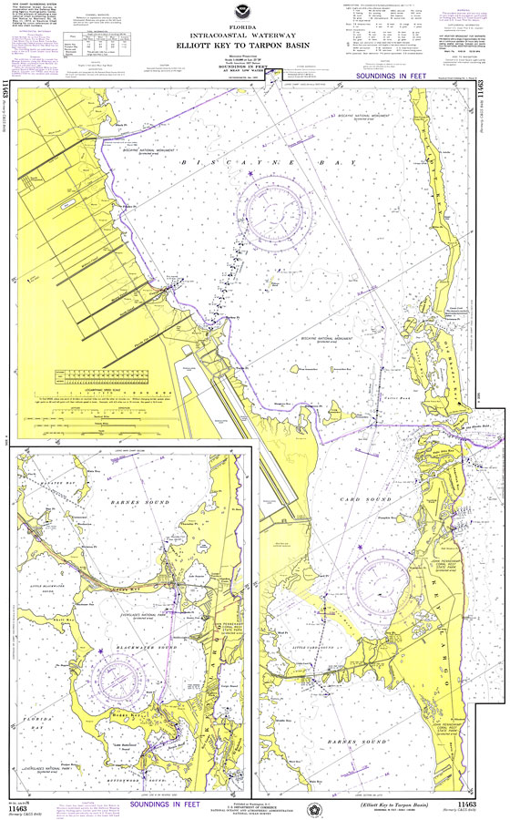
Description: A National Oceanic and Atmospheric Administration map of the area of Elliott Key to Tarpon Basin, Florida current to1976. This Department of Commerce chart shows all soundings expressed in feet at mean lower low water. Navigational aids such as lights, beacons, buoys and measures of magnetic declination variances are shown as well as obstructions such as shoals, submerged piles, wreckages, fixed bridges and overhead cables. The map scale is 1:40,000. North American Datum of 1927 is used. A detailed map of Key Largo is included. Key to NOAA maps.
Place Names: Monroe, Old Rhodes Key, Key Largo, Barnes Sound, Boggy Key, Blackwater Sound, Biscayne Bay, Elliott Key,
ISO Topic Categories:
Keywords: Elliott Key to Tarpon Basin, physical, transportation, hydrological, physical features, roads, water routes, water depths, Mercator, 1976
Source: National Oceanic and Atmospheric Administration, Florida Intracoastal Waterway (Washington, DC: U.S. Department of Commerce, 1976)
Map Credit: Courtesy the U.S. National Oceanic and Atmospheric Administration |
|