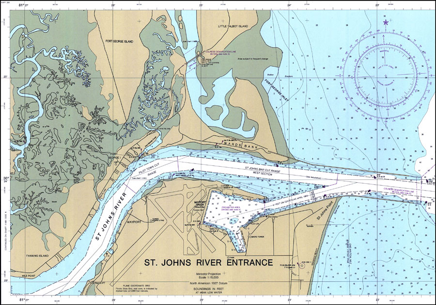
Description: A National Oceanic and Atmospheric Administration map of the entrance to the St. Johns River, current to 1986. This National Ocean Survey chart shows all soundings expressed in feet. Navigational aids such as channel depths, lights, beacons, buoys and measures of magnetic declination variances are shown as well as obstructions such as submerged rocks and piles. Restricted areas and danger areas due to mines on the bottom are also included. North American 1927 Datum used. The map scale is 1:15,000. NOAA Map Reference: 11490-11-1986. Key to NOAA maps. PLEASE NOTE: This historical data is not to be used for navigation or navigation planning. The Florida Center for Instructional Technology (FCIT) does not assume responsibility for the improper use of these data.
Place Names: Duval, Wards Bank, Mayport Basin, St. Johns Point
ISO Topic Categories: transportation, oceans, inlandWaters
Keywords: St. Johns River Entrance, physical, transportation, hydrological, physical features, roads, water routes, water depths, transportation, oceans, inlandWaters, Mercator, 1986
Source: National Oceanic and Atmospheric Administraton, National Ocean Survey (Washington, DC: National Oceanic and Atmospheric Administration, 1986)
Map Credit: Courtesy the U.S. National Oceanic and Atmospheric Administration |
|