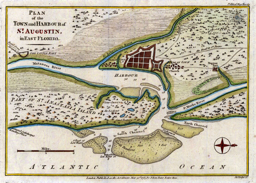
Description: Digitization provided by the USF Libraries Digitization Center. Rare Maps. This is a map of St. Augustine and its harbor, circa 1783. This map shows roads, water depths, locations, physical features and inland waters. Also shown are forts, Indian towns and General Oglethorpe's Landing Place. Measurements.Dimensions: 18 x 25 cm
Place Names: St. Johns, Saint Augustine, St. Augustine, Atlantic Ocean, St. Marks River, Matanzas River, St. Sebastians River, Anastasia Island, Castillo de San Marcos
ISO Topic Categories: inlandWaters, transportation, location
Keywords: Plan of the Town and Harbour of St. Augustin in East Florida, historical, transportation, physical, hydrological, physical features, roads, water depths, inlandWaters, transportation, location, Unknown,1783 AD
Source: John Lodge & J. Bew, Political Magazine (London, : William Child, 1783)
Map Credit: Courtesy of the Special Collections Department, University of South Florida. |
|