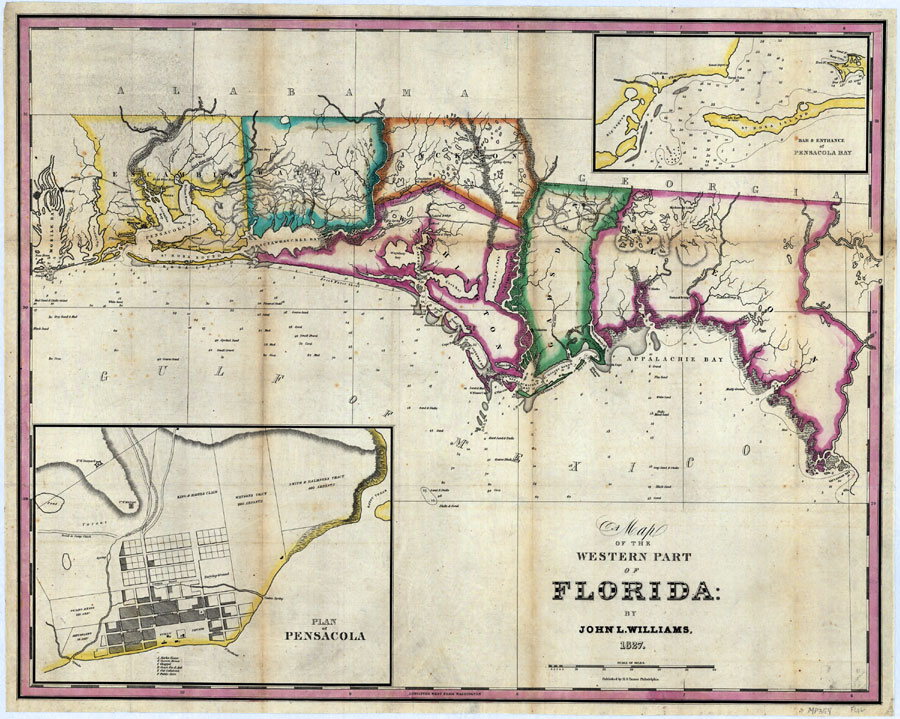
Description: Digitization provided by the USF Libraries Digitization Center. Rare Maps. This is a detailed map of the western part of Florida, circa 1827. There are two inset maps of Pensacola, "Bar & Entrance of Pensacola Bay" and "Plan of Pensacola." This map shows counties, cities and towns, inland waters, physical features, water depths, roads and location. Measurements.Dimensions: 55 x 71 cm., on sheet 60 x 76 cm. Measurements.Resolution: Scale [ca. 1:675,840]
Place Names: 1820-1839, Escambia, Pensacola, Walton, Jackson, Washington, Gadsden, Tallahassee, Leon, Gulf of Mexico
ISO Topic Categories: inlandWaters, transportation, location, boundaries
Keywords: Map of the Western Part of Florida, transportation, physical, hydrological, political, historical, physical features, county borders, roads, water depths, inlandWaters, transportation, location, boundaries, Unknown,1827 AD
Source: John L. Williams, (Philadelphia, PA: H. S. Tanner, 1827)
Map Credit: Courtesy of the Special Collections Department, University of South Florida. |
|