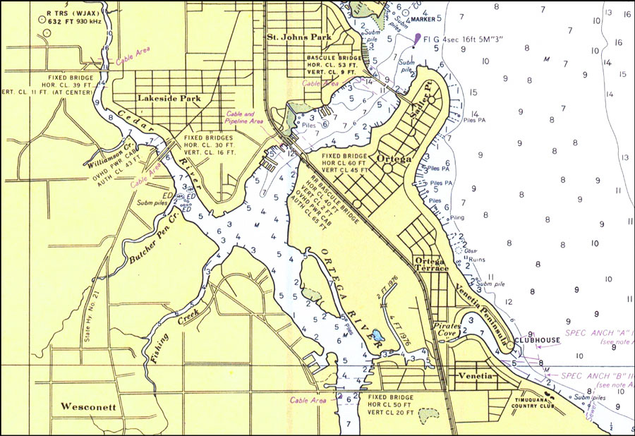
Description: A National Oceanic and Atmospheric Administration map of the St. Johns River near Ortega, Florida current to 1977. This East Coast Survey chart shows all soundings expressed in feet. Navigational aids such as lights, beacons, and buoys are shown as well as obstructions such as fixed bridges, overhead power cable areas, pipes, and piles. North American 1927 Datum used. The map scale is 1:40,000. Key to NOAA maps.
Place Names: 1950-1999, St. Johns Park, Ortega, Venetia, Lakeside Park
ISO Topic Categories: transportation, inlandWaters
Keywords: St. Johns River: Ortega, physical, transportation, hydrological, physical features, roads, railroads, water routes, water depths, transportation, inlandWaters, Mercator, 1977
Source: National Oceanic and Atmospheric Administration, St. Johns River: Jacksonville to Racy Point (Washington, DC: National Oceanic and Atmospheric Administration, 1977)
Map Credit: Courtesy the U.S. National Oceanic and Atmospheric Administration |
|