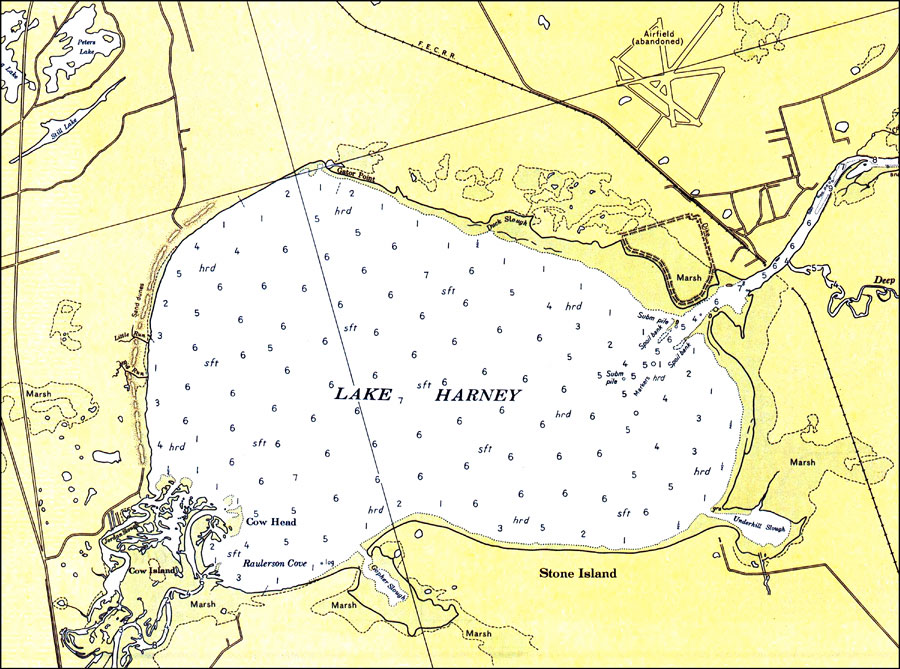
Description: A National Oceanic and Atmospheric Administration map of the St. Johns River near Lake Harney current to 1979. This National Ocean Survey chart shows all soundings expressed in feet. This map shows marshes, inland waters such as Lake Harney and other lakes and islands such as Stone Island. North American 1927 Datum used. The map scale is 1:40,000. NOAA Map Reference: 11495_A-4-1979. Key to NOAA maps. PLEASE NOTE: This historical data is not to be used for navigation or navigation planning. The Florida Center for Instructional Technology (FCIT) does not assume responsibility for the improper use of these data.
Place Names: 1950-1999, Lake Harney
ISO Topic Categories: transportation, �inlandWaters
Keywords: St. Johns River: Lake Harney, physical, �transportation, �hydrological, physical features, roads, �railroads, �water routes, water depths, transportation, �inlandWaters, Mercator, 1979
Source: National Oceanic and Atmospheric Administration, St. Johns River: Lake Dexter to Lake Harney (Washington, DC: National Oceanic and Atmospheric Administration, 1979)
Map Credit: Courtesy the U.S. National Oceanic and Atmospheric Administration |
|