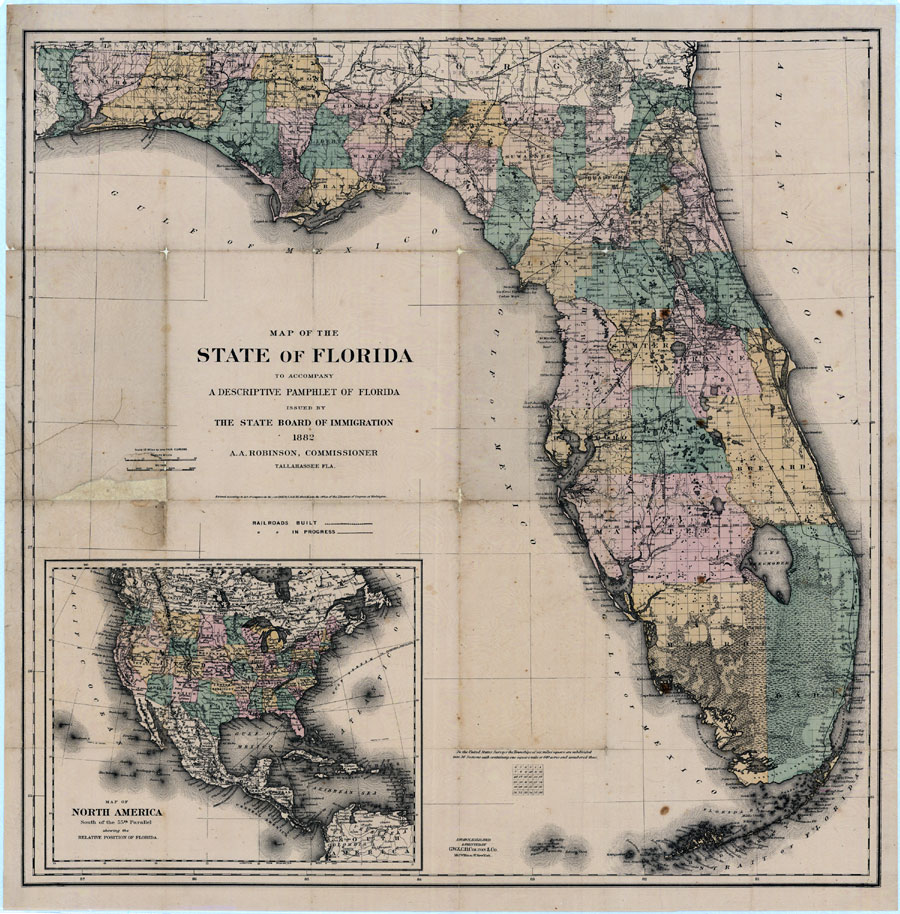
Description: Digitization provided by the USF Libraries Digitization Center. Rare Maps. This is a detailed map of Florida, circa 1882. This map shows railroads, counties, cities and towns and inland waters. There is an inset map of "North America south of the 55th Parallel showing the relative position of Florida." Measurements.Resolution: Scale [ca. 1:1,140,000]
Place Names: 1880-1899, Pensacola, Tallahassee, Jacksonville, Saint Augustine, Cape Canaveral, Tampa, Key West, Gulf of Mexico, Atlantic Ocean, Daytona Beach, Fort Lauderdale, Fort Myers, Gainesville, Miami, Orlando, Sarasota
ISO Topic Categories: transportation, boundaries, inlandWaters, oceans
Keywords: Map of the State of Florida, transportation, political, historical, county borders, local jurisdictions, railroads, transportation, boundaries, inlandWaters, oceans, Unknown,1882
Source: G. W. & C. B. Colton & Co., Florida: a pamphlet descriptive of its history, topography, climate, soil, resources and natural advantages (New York, NY: G. W. & C. B. Colton & Co., 1882)
Map Credit: Courtesy of the Special Collections Department, University of South Florida. |
|