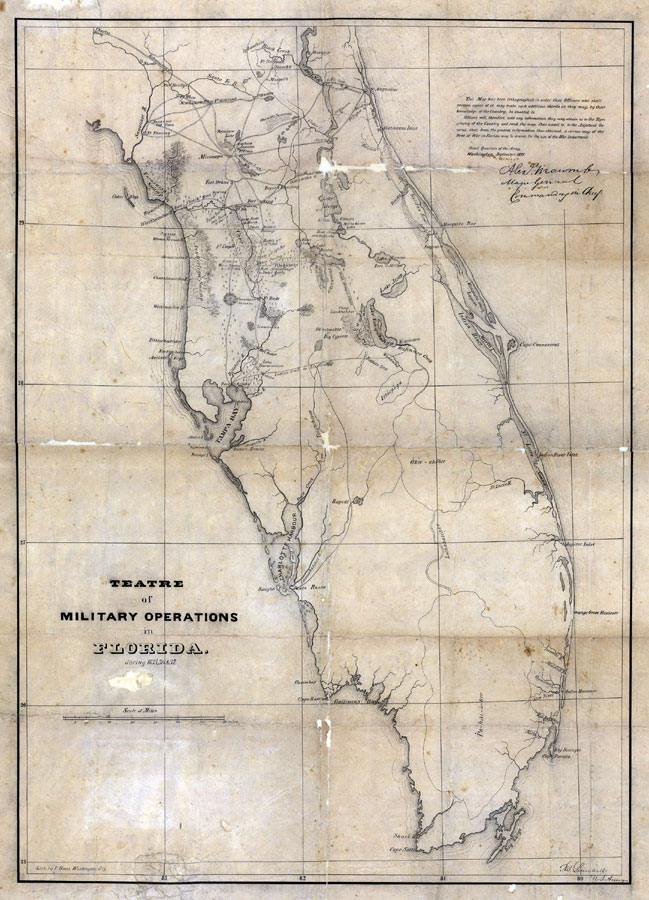
Description: Digitization provided by the USF Libraries Digitization Center. Rare Maps. This is a map of Florida showing the theatre of military operations from 1835 to 1837. It shows military roads, troop locations, fortifications, inland waters, cities and towns. Text surrounding map is original. The original title on the map reads "Teatre [sic] of Military Operations in Florida." Measurements.Dimensions: 56 x 44 cm., on sheet 68 x 46 cm. Measurements.Resolution: Scale [1:633,600. 1 in. to 10 miles]
Place Names: 1820-1839, Saint Augustine, Cape Canaveral, Gulf of Mexico, Atlantic Ocean
ISO Topic Categories: transportation, inlandWaters, oceans, society
Keywords: Theatre of Military Operations in Florida, transportation, historical, roads, other military, transportation, inlandWaters, oceans, society, Unknown,1835-1837
Source: P. Hans, (Washington, DC: P. Hans, 1837)
Map Credit: Courtesy of the Special Collections Department, University of South Florida. |
|