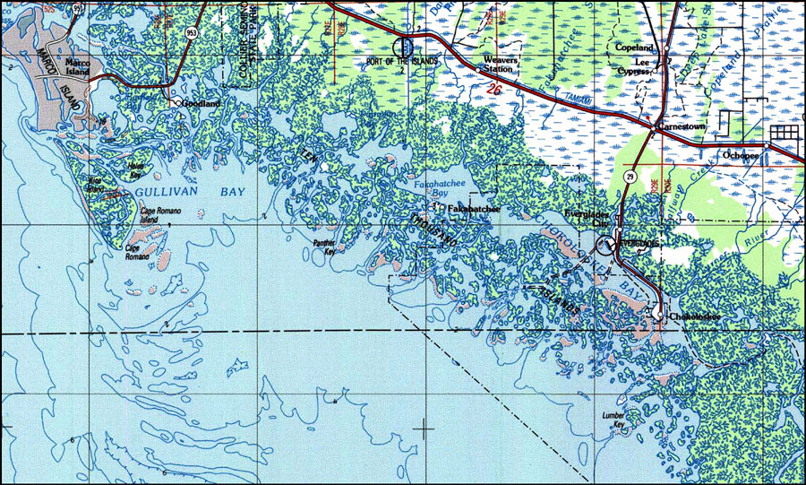
Description: A US Geological Survey and National Ocean Service map of the Ten Thousand Islands area of south Florida current to 1988. This topographic-bathymetric map shows elevations and depths in meters. Contour interval 5 meters. Bathymetric contour interval 10 meters. Map also includes roads, waterways, airports, national parks and refuges, swamps, and forests. North American 1927 Datum used. The map scale is 1:250,000, metric . Key to USGS maps.
Place Names: 1950-1999, Ten Thousand Islands, Marco Island, Everglades City, Chokoloskee, Cape Romano
ISO Topic Categories: transportation, inlandWaters, elevation
Keywords: Ten Thousand Islands, Florida, physical, transportation, hydrological, physical features, topographical, roads, water routes, water depths, transportation, inlandWaters, elevation, Unknown,1988
Source: US Geological Survey and National Ocean Service, Miami Area Topographic-Bathymetric Map (Colorado Springs, CO: US Geological Survey, 1988)
Map Credit: Courtesy the U.S. National Oceanic and Atmospheric Administration |
|