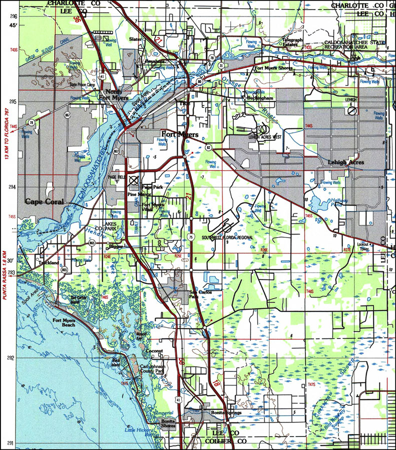
Description: A US Geological Survey and National Ocean Service map of Lee County in south Florida current to 1987. This topographic-bathymetric map shows elevations and depths in meters. Contour interval 5 meters. Bathymetric contour interval 10 meters. Map also includes roads, waterways, airports, swamps, and forests. Map divided into townships and ranges. North American 1929 Datum used. The map scale is 1:250,000, metric . Key to USGS maps.
Place Names: Lee, Ft. Myers, North Fort Myers, Fort Myers Beach, Bonita Springs, San Carlos Park, Cape Coral, Caloosahatchee River
ISO Topic Categories: transportation, inlandWaters, oceans, elevation
Keywords: Lee County, Florida, physical, political, transportation, hydrological, physical features, topographical, county borders, roads, railroads, water routes, water depths, transportation, inlandWaters, oceans, elevation, Unknown,1987
Source: US Geological Survey and National Ocean Service, West Palm Beach to Naples (Reston, VA: US Geological Survey, 1987)
Map Credit: Courtesy the U.S. National Oceanic and Atmospheric Administration |
|