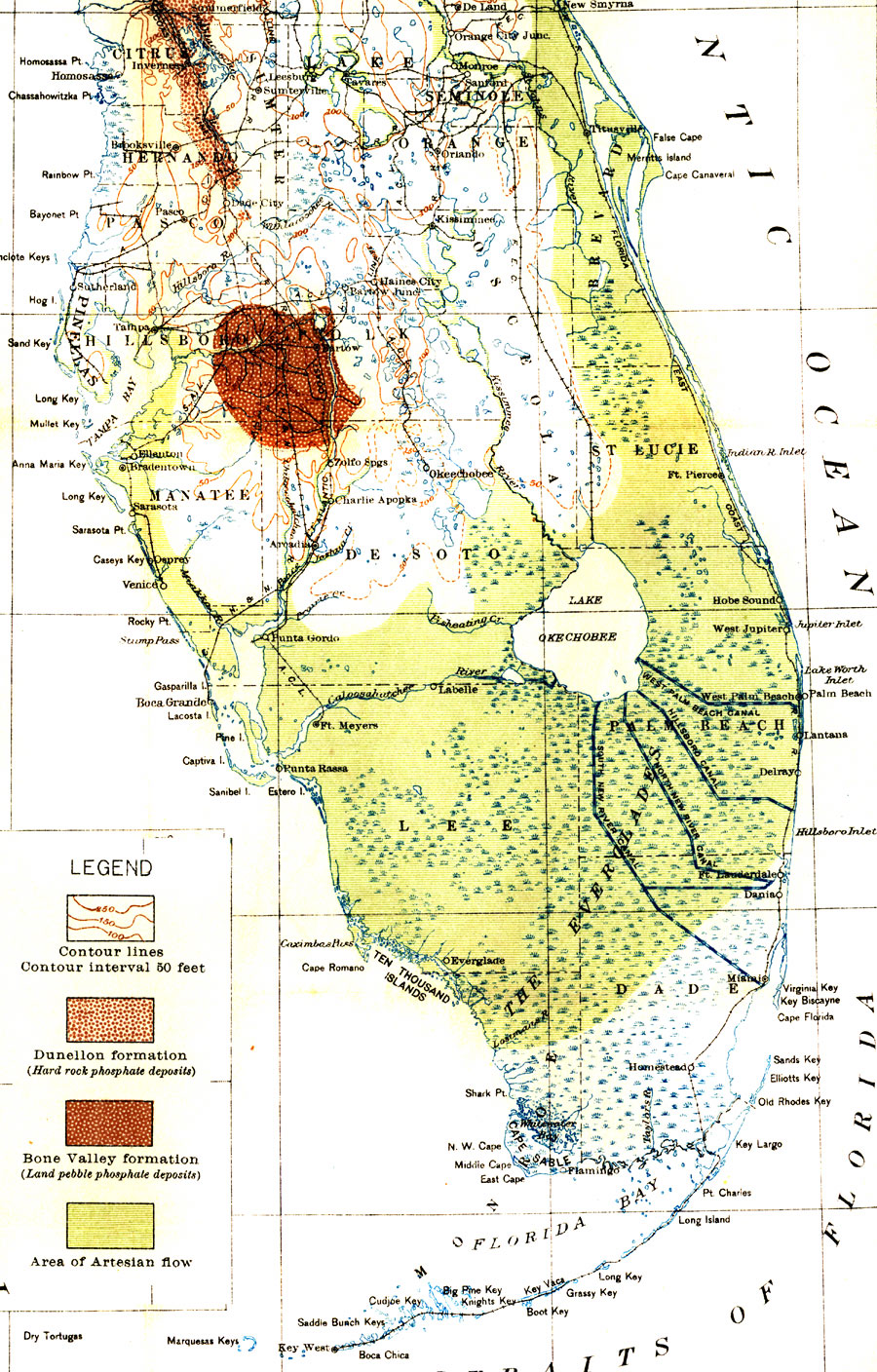
Description: Digitization provided by the USF Libraries Digitization Center. Rare Maps. This is a detail map of the Everglades and Lake Okeechobee showing the area's proposed drainage and artesian flow, circa 1913. Text from the main map states, "The inclusion of the Everglades within the flowing belt is hypothetical, no deep wells having been drilled as yet within this area. It seems probable however, that a flow will be obtained in the Everglades, although at a considerable depth. Whether or not flowing wells will be obtained on the mainland of extreme Southern Florida is undetermined."
Place Names: 1900-1919, Gulf of Mexico, Atlantic Ocean, West Palm Beach, Fort Lauderdale, Miami, Fort Myers
ISO Topic Categories: inlandWaters, boundaries, oceans, transportation
Keywords: Map of Everglades Drainage, transportation, historical, physical, political, hydrological, physical features, county borders, water routes, drainage basins, inlandWaters, boundaries, oceans, transportation, Unknown,1913
Source: Elias Howard Sellards, Ph. D., state geologist, Florida State Geological Survey (Tallahassee, FL: A. Hoen & Co., 1913)
Map Credit: Courtesy of the Special Collections Department, University of South Florida. |
|
