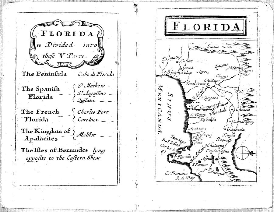
Description: Digitization provided by the USF Libraries Digitization Center. Rare Maps. This is a map of Florida which includes present day southeast U. S., circa 1679. The text on the map states "Florida is divided into five parts: The Peninsula, The Spanish Florida, The French Florida, The Kingdom of Apalacites, The Isles of Bermudes." The "Kingdom of Apalacites" may have been an Indian kingdom. Present day Florida is at the bottom left corner of this map. The map is actually turned clockwise. Measurements.Dimensions: 15 x 11.5 cm.
Place Names: Before 1700, St. Mathew, Saint Augustine, Charles Fort, Carolina, Melilot, Bermuda, Gulf of Mexico
ISO Topic Categories: inlandWaters, oceans
Keywords: Florida, historical, physical, political, physical features, inlandWaters, oceans, Unknown,1679
Source: John Seller, hydrographer to the King and Queen, Atlas terrestris, or, A book of mapps of all the empires, monarchies, kingdoms, regions, dominions, principalities and countreys in the whole world (London, : John Seller, hydrographer to the King and Queen, 1679)
Map Credit: Courtesy of the Special Collections Department, University of South Florida. |
|