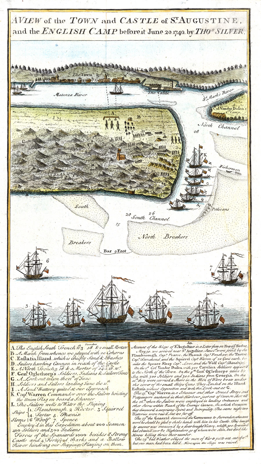
Description: Digitization provided by the USF Libraries Digitization Center. Rare Maps. This is a perspective map of St. Augustine showing an account of the siege of St. Augustine along with a letter from on board the ship Hector, circa 1740. The map is quite detailed showing ships with their names in a key, a key for physical features and troop positions, houses, Castillo de San Marcos (castle), water depths and military camps. The text from the letter beneath the map that explains the siege in detail. Measurements.Dimensions: 20 x 16 cm., on sheet 31 x 22 cm.
Place Names: St. Johns, Saint Augustine, St. Augustine, St. Marks River, Matanza River, Matanzas River, Castillo de San Marcos, Atlantic Ocean
ISO Topic Categories: inlandWaters, oceans, society, transportation
Keywords: A View of the town and castle of St. Augustine, and the English camp before it, historical, physical, political, transportation, hydrological, physical features, water routes, other military, water depths, inlandWaters, oceans, society, transportation, Unknown,June 20, 1740
Source: Thomas Silver, (London, : , 1742)
Map Credit: Courtesy of the Special Collections Department, University of South Florida. |
|