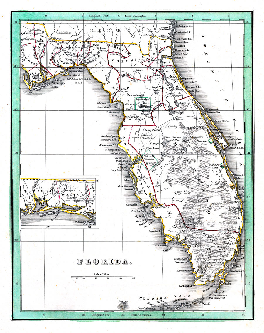
Description: Digitization provided by the USF Libraries Digitization Center. Rare Maps. This is a map of Florida, circa 1835. There's an inset map showing the western panhandle portion of the state. It shows counties, cities and towns, grants (Arredondos and Mirandas grants) and inland waters. It shows latitude from Greenwich and Washington. Measurements.Dimensions: 23 x 28.5 cm
Place Names: 1820-1839, Pensacola, Saint Augustine, Jacksonville, Cape Canaveral, Tampa, Gulf of Mexico, Atlantic Ocean, St. Johns River, Lake Okeechobee, Lake Macaco, Tallahassee, Key West
ISO Topic Categories: inlandWaters, oceans, transportation, boundaries
Keywords: Florida, historical, political, transportation, county borders, country borders, inlandWaters, oceans, transportation, boundaries, Unknown,1835
Source: George W. Boynton, engraver & Thomas G. Bradford, publication author, A comprehensive atlas, geographical, historical and commercial (Boston, MA: W. D. Ticknor, 1835)
Map Credit: Courtesy of the Special Collections Department, University of South Florida. |
|