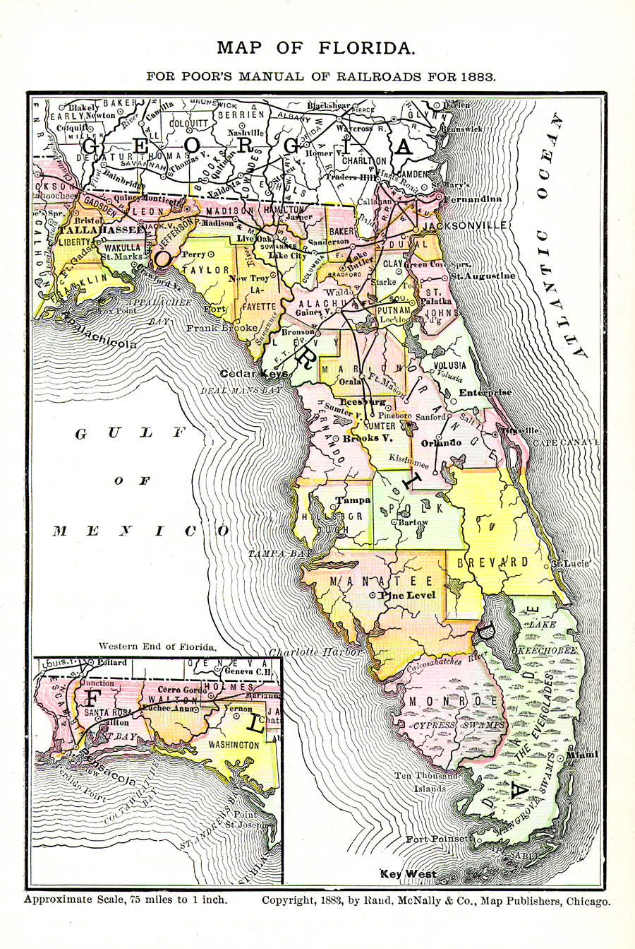
Description: Digitization provided by the USF Libraries Digitization Center. Rare Maps. This is a railroad map of Florida, circa 1883. There's an inset map showing the western end of the state. It shows railroads, counties, cities and towns and inland waters. According to the USF library, "Poor's Manual of Railroads was an annual publication from 1868 to 1924 and included railroad financial reports and short histories." Measurements.Dimensions: 13.5 x 20 cm. Measurements.Resolution: Scale [ca. 1:4,750,000]
Place Names: 1880-1899, Pensacola, Saint Augustine, Jacksonville, Cape Canaveral, Tampa, Gulf of Mexico, Atlantic Ocean, St. Johns River, Lake Okeechobee, Tallahassee, Key West, Gainesville, Orlando, Miami
ISO Topic Categories: inlandWaters, oceans, transportation, boundaries
Keywords: Map of Florida for Poor's Manual of Railroads, political, transportation, county borders, railroads, inlandWaters, oceans, transportation, boundaries, Unknown,1883
Source: Henry Varnum Poor, compiler, Poor's manual of railroads 1883: Manual of the railroads of the United States (Chicago, IL: Rand McNally and Company, 1883)
Map Credit: Courtesy of the Special Collections Department, University of South Florida. |
|