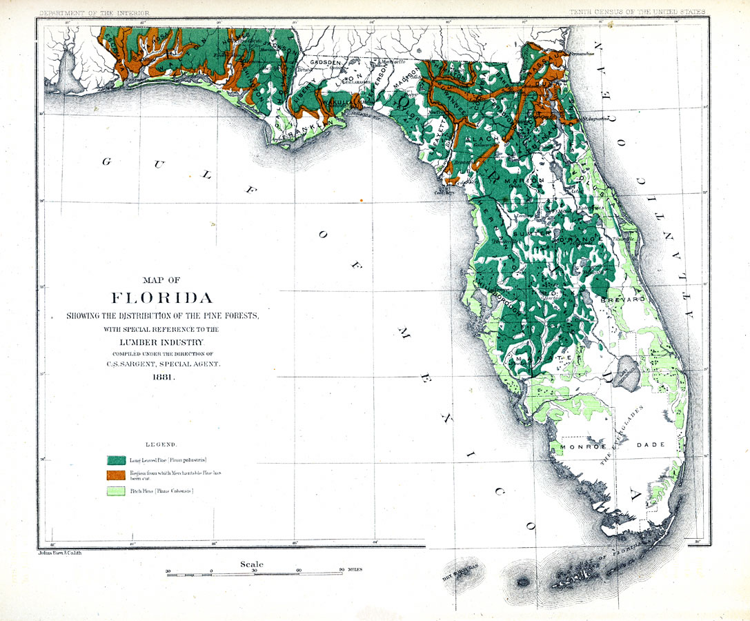
Description: Digitization provided by the USF Libraries Digitization Center. Rare Maps. This is a map of Florida showing the distribution of pine forests with special reference to the lumbar industry, circa 1881. It has a key showing three different sections and two species of pine: Long Leaved Pine, Region from which Merchantable Pine has been cut and Pitch Pine. It also shows cities, towns and counties. Measurements.Dimensions: 26 x 21 cm. Measurements.Resolution: Scale [ca. 1:550240].
Place Names: Conifers, Pensacola, Tallahassee, Jacksonville, Gainesville, Orlando, Tampa, Saint Augustine, Miami, Key West, Gulf of Mexico, Atlantic Ocean, natural distribution of native tree species
ISO Topic Categories: inlandWaters, oceans, boundaries, environment
Keywords: Map of Florida showing the distribution of the pine forests, historical, physical, political, forestry, statistical, country borders, county borders, industry, inlandWaters, oceans, boundaries, environment, Unknown,1881 AD
Source: R. H. Scott & Charles S. Sargent, Report on forests of North America (exclusive of Mexico) (Washington, D. C.: U. S. Census Office, 10th Census, 1880, U. S. Dept. of the Interior, 1881)
Map Credit: Courtesy of the Special Collections Department, University of South Florida. |
|