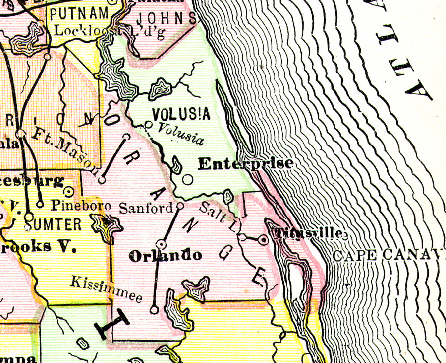
Description: Digitization provided by the USF Libraries Digitization Center. This Orange County map is from PoorŐs railroad map of Florida, circa 1883. It shows railroads, counties and county seats, cities and towns and inland waters. Approximate map scale is 75 miles to 1 inch. This particular map shows Orange County extending eastward to the Atlantic Ocean and includes Titusville (currently Brevard County). Orlando is the County Seat. Railroad lines are two short segments between Fort Mason and Astor, and Sanford, Orlando, Kissimmee.
Place Names: Orange, Titusville, Salt Lake, Ft. Mason, Orlando, Kissimmee, Sanford
ISO Topic Categories: inlandWaters, transportation, boundaries
Keywords: Orange County, political, transportation, county borders, railroads, inlandWaters, transportation, boundaries, Unknown,1883
Source: Henry Varnum Poor, compiler, Poor's manual of railroads 1883: Manual of the railroads of the United States (Chicago, IL: Rand McNally and Company, 1883)
Map Credit: Courtesy of the Special Collections Department, University of South Florida. |
|